
Tabula Peutingeriana – Single display of hits
| Toponym TP (renewed): | Roma |
| Name (modern): | Roma/Rome/Rom |
| Image: | 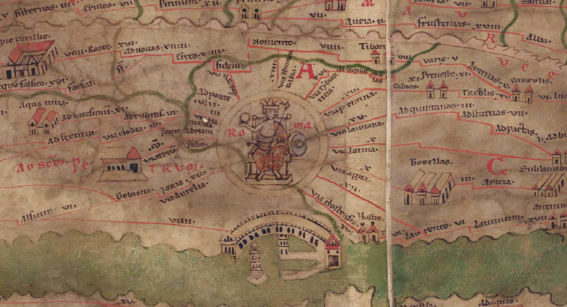 To the image detail |
| Toponym before | Via Salaria Via Flaminia Ponte adriani (Ponte Adriani) Via Aurelia |
| Toponym following | Via Numentana (Via Numentana) Via Tyburtina (Via Tiburtina) Via Prentina (Via Praenestina) Via lauicana (Via Lavicana) Via Latina Via Appia [Via Laurentina] Via Hostensis |
| Alternative Image |
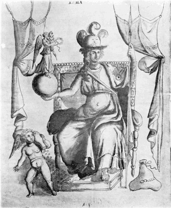 |
| Image (Barrington 2000) |
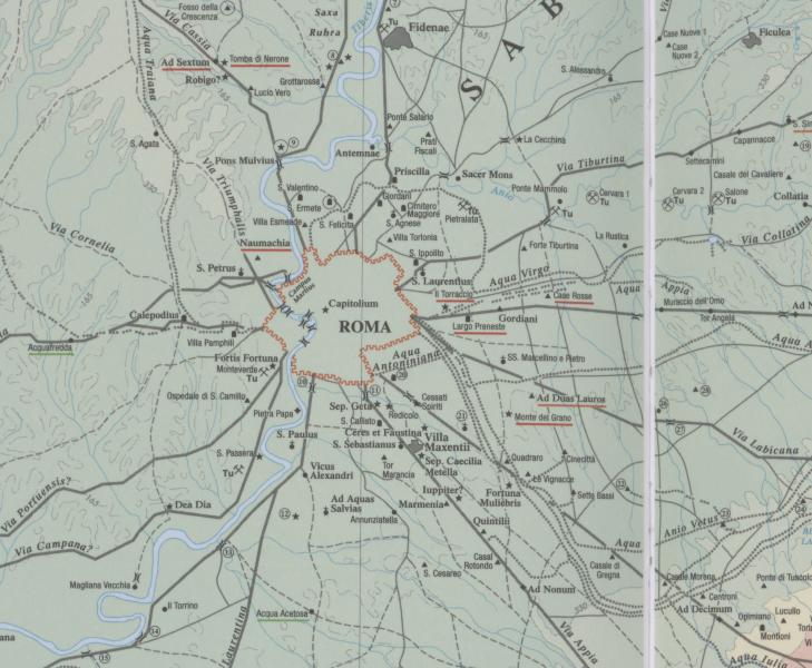 |
| Image (Scheyb 1753) |
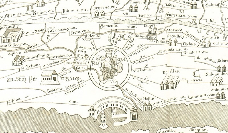 |
| Image (Welser 1598) | --- |
| Image (MSI 2025) | --- |
| Pleiades: | https://pleiades.stoa.org/places/423025 |
| Wikipedia | https://en.wikipedia.org/wiki/Ancient_Rome |
| Area: | Italy |
| Toponym Type: | Toponym with Symbol |
| Grid square: | 4B5 |
| Toponym Color: | red |
| Vignette Type : | F Great Vignette |
| Itinerary: | Ab Urbe (106,5; 123,8; 124,8; 301,6; 302,2; 304,6; 305,8; 306,4; 308,5; 310,6, 497,10; 612,10), Romam (284,7), Roma (286,5; 286,6; 289,4; 300,1; 300,6), Per Urbem Romam (594,4), In urbe Roma (612,4; 612,7), ad urbem Romam (612,5), Ab Urbe Roma (617,6) |
| Alternative Name (Lexica): | Roma III. Topographie (DNP) |
| Name A (RE): | Rom - https://ia600209.us.archive.org/1/items/PWRE48/Pauly-Wissowa_I_A1_1007.png |
| Name B (Barrington Atlas): | Roma (43 B2 / 44 B2) |
| Name C (TIR/TIB/others): |
|
| Name D (Miller): | Roma |
| Name E (Levi): | Roma (F) |
| Name F (Ravennate): | Roma (p. 71.30; 85.47), Romam (p. 72.10; 72.11; 72.36; 73.02; 73.41; 74.09) |
| Name G (Ptolemy): | Ἄστυ Ῥώμη (3,1,61); βασίλειον Ῥώμη (8,8,3) |
| Plinius: | Urbs (3,17; 3,43; 3,53; 3,66; 3,67), Roma, terrarum caput (3,38), Urbs Roma (3,40; 3,44), Roma (3,64; 3,68; 3,116; 4,20), pars Romae (3,68) |
| Strabo: | Ῥώμη (5,3,7; 5,3,8; 5,3,9; 5,3,10; 5,3,11; 5,3,12; 5,3,13) |
| Dating from Toponym on TP: | Classic (5th/4th century BC) |
| Argument for Dating: |
|
| Commentary on the Toponym: |
Antike Namensformen: |
| References: |
[1] Bühl, G., Constantinopolis und Roma, Stadtpersonifikationen der Spätantike, Zurich 1995, S. 130-34. 177. 210. |
| Last Update: | 10.12.2025 19:30 |
Cite this page:
https://tp-online.ku.de/trefferanzeige_en.php?id=222 [last accessed on June 24, 2026]