
Tabula Peutingeriana – Single display of hits
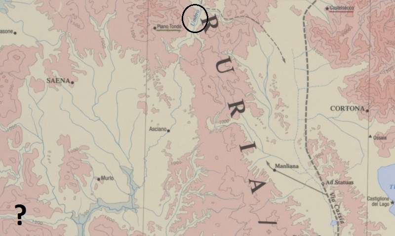
| Toponym TP (renewed): | Vmbro Flumen (Umbro Flumen) |
| Name (modern): |
|
| Image: | 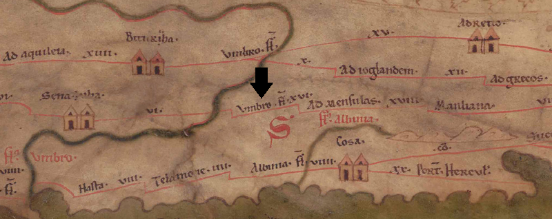 To the image detail |
| Toponym before | VI Sena Iulia |
| Toponym following | XVI Ad Mensulas |
| Alternative Image | --- |
| Image (Barrington 2000) |
 |
| Image (Scheyb 1753) | --- |
| Image (Welser 1598) | --- |
| Image (MSI 2025) | --- |
| Area: | Italy |
| Toponym Type: | Toponym, no Symbol |
| Grid square: | 3B3 / 3B4 |
| Toponym Color: | black |
| Vignette Type : | --- |
| Itinerary: |
|
| Alternative Name (Lexica): |
|
| Name A (RE): |
|
| Name B (Barrington Atlas): | *Umbro fl. (42 B2) [bezieht sich auf Umbro fl. (1)] |
| Name C (TIR/TIB/others): | Umbro fl. (TIR K 32, 184, 910) |
| Name D (Miller): | Umbro fl. |
| Name E (Levi): |
|
| Name F (Ravennate): | Umbro (p. 74.22) |
| Name G (Ptolemy): |
|
| Plinius: |
|
| Strabo: |
|
| Dating from Toponym on TP: | --- |
| Argument for Dating: |
|
| Commentary on the Toponym: |
Kommentar (Köhner) |
| References: |
Desjardins, Table, p. 146, col. 2, no. 3. |
| Last Update: | 23.10.2025 14:47 |
Cite this page:
https://tp-online.ku.de/trefferanzeige_en.php?id=122 [last accessed on June 26, 2026]