deutsch englisch spanisch französisch italienisch
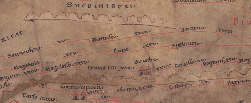
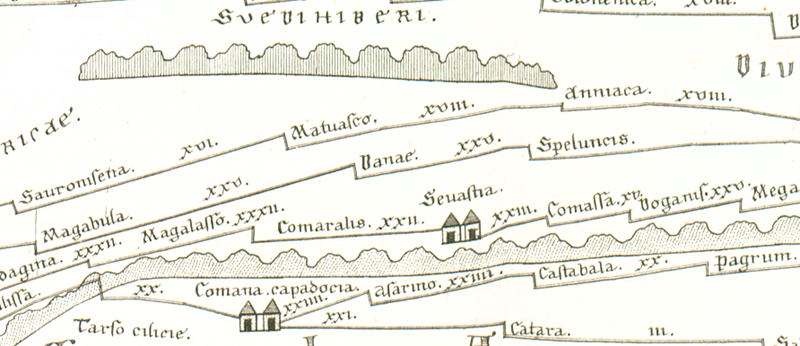
Ausschnitt aus der Tabula Peutingeriana - Rom

Tabula Peutingeriana – Display individuale

Toponimo TP (sciolto):

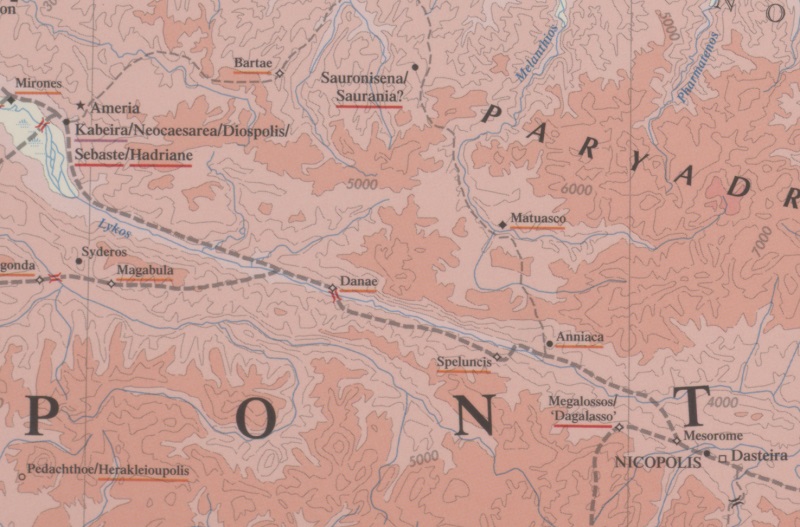
Danae

Nome (moderno):

? Kündür

Foglio:
Al dettaglio dell'immagine
Toponimo davanti XXV     Magabula     
Toponimo dopo XXV     Speluncis     
Foglio alternativo: ---
Foglio (Barrington 2000)
Foglio (Scheyb 1753)
Foglio (Welser 1598) ---
Foglio (MSI 2025) ---
Pleiades: https://pleiades.stoa.org/places/857102
Area:

Asia Minore

Tipo di toponimo:

nome di luogo senza simbolo

Quadrato:

9A4

Colore di toponimo:

nero

Tipo di vignetta:

---

Nome (Itinerario):


Nome alternativo (dizionari):


Nome (RE):

Danaë 1

Nome (Barrington):

Danae (87 C4)

Nome (TIR / TIB /altro):


Nome (Miller):

Danae

Nome (Levi):


Nome (Ravennat):


Nome (Ptolemaios):

Δανάη (var. lect. Δάνατι) (5,6,10)

Plinius:


Strabo:


Datazione del toponimo sulla TP:

periodo imperiale (II secolo)

Giustificazione della datazione:

Sonst nur noch belegt bei Ptol.

Commento al toponimo:

Gleiche Namensform:
Δανάη (var. lect. Δάνατι) Ptol. 5,6,10 (als Stadt im Landesinnern des Polemoniakischen Pontos aufgeführt zwischen Zela/Zile und Sebasteia/Sivas).

Es handelt sich vielleicht um eine griech. mytholog. Namensgebung oder um die Hellenisierung eines einheimischen namens, wie Δάνα (s. Zgusta 1984).

Station an der Strecke von Comana Pontica nach Nicopolis im Pontos Polemoniakos im Tal des Iris bzw. an seinem Quellfluss Tozanlı Irmak (s. Olshausen/Biller 1984). (Nicht identisch mit Doranum zwischen Tavia und Sebastia im ItAnt 205,s. Ruge, RE 2084).
Ruinenfunde beim Dorf Tozanlıfındıcak/Reşadiye südwestl. von Kündür (s. Bryer/Winfield 1985, 23 mit Anm. 58).

Meilenangabe nach Speluncis: XXV (25).

Letteratura:

Bryer, A. A. M./Winfield, D. C.: The Byzantine monuments and topography of the Pontos, 2 Bde., Washington DC 1985, 23f.

Miller, Itineraria, Sp. 675.

Olshausen, E./Biller, J.: Historisch-geographische Aspekte der Geschichte des Pontischen und Armenischen Reiches. Teil I. Untersuchungen zur historischen Geographie von Pontos unter den Mithridatiden (= TAVO B 29/1), Wiesbaden 1984, 124.

Ruge, W.: Danaë 1, RE 4,2 (1901), 2084.

Sinclair, T. A.: Eastern Turkey: an architectural and archaeological survey, London 1989-90.

Wilson, D. R.: The Historical Geography of Bithynia, Paphlagonia and Pontus in the
Greek and Roman Periods: a new survey with particular reference to surface remains
still visible, Diss. Oxford 1966, 391.

Zgusta, Ladislav: Kleinasiatische Ortsnamen, Heidelberg 1984, 236.

   [Standard-Literatur-Liste im PDF-Format]

Ultima modifica:

18.08.2025 17:18


Cite this page:
https://tp-online.ku.de/trefferanzeige_it.php?id=1383 [zuletzt aufgerufen am 11.11.2026]

Impressum Datenschutzerklärung