
Tabula Peutingeriana – Pantalla individual
| Topónimo (simplificado): | Roschirea |
| Nombre (moderno): |
|
| Imagen: | 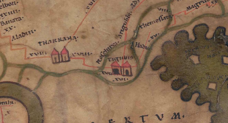 Al detalle de la imagen |
| Topónimo antes | XVIII Tharrana |
| Topónimo después | XVII Tigubis |
| Imagen alternativa | --- |
| Imagen (Barrington 2000) | --- |
| Imagen (Scheyb 1753) | --- |
| Imagen (Welser 1598) | --- |
| Imagen (MSI 2025) | --- |
| Pleiades: | https://pleiades.stoa.org/places/876690 |
| Área: | Asia al este del Eufrates, al sur del Tarurus |
| Tipo de topónimo: | Topónimo sin símbolo |
| Cuadrícula: | 10C3 |
| Color del topónimo: | negro |
| Tipo de viñeta: | --- |
| Itinerario: |
|
| Nombres alternativos (diccionarios): |
|
| Nombre A (RE): |
|
| Nombre B (Barrington Atlas): | Roschirea/Vesceria (89 unlocated) |
| Nombre C (TIR / TIB /otros): |
|
| Nombre D (Miller): |
|
| Nombre E (Levi): |
|
| Nombre F (Ravenate): |
|
| Nombre G (Ptolemaios): |
|
| Plinius: |
|
| Strabo: |
|
| Datación del topónimo en la TP: | --- |
| Fundamento para la datación: |
|
| Comentario al topónimo: |
Kommentar (Talbert): |
| Bibliografía: |
Miller, Itineraria, Sp. 778; |
| Última elaboración: | 14.04.2025 17:17 |
Cite this page:
https://tp-online.ku.de/trefferanzeige_es.php?id=1787 [zuletzt aufgerufen am 06.04.2026]