deutsch englisch spanisch französisch italienisch
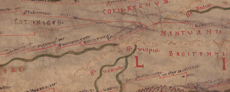
Part of Tabula Peutingeriana - Rome

Tabula Peutingeriana – Single display of hits

Toponym TP (renewed):

Rama

Name (modern):

(near La Roche-de-Rme) (Barrington) / Casse-Rom (Miller)

Image:
To the image detail
Toponym before XVII     Eburuno     
Toponym following XVIIII     Brigantione     
Alternative Image ---
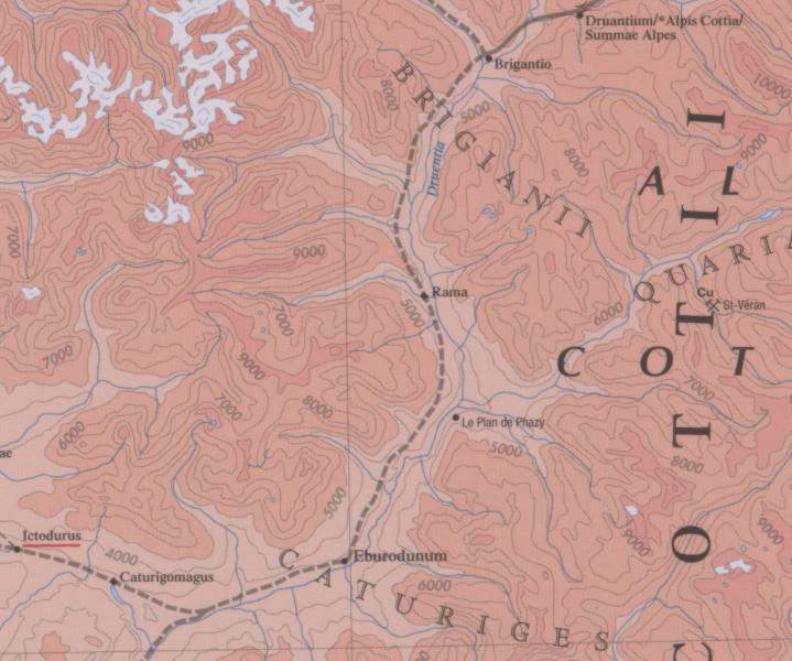
Image (Barrington 2000)
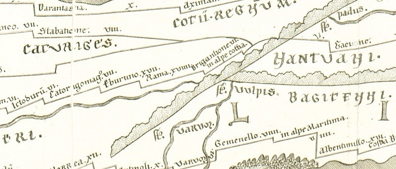
Image (Scheyb 1753)
Image (Welser 1598) ---
Image (MSI 2025) ---
Area:

Gaul/Germania

Toponym Type:

Toponym, no Symbol

Grid square:

2B2 / 2B3

Toponym Color:

black

Vignette Type :

---

Itinerary:

Rame (341,6), Ramae (357,4), mutatio Ramae (555,10)

Alternative Name (Lexica):


Name A (RE):

Rama

Name B (Barrington Atlas):

Rama (17 H4)

Name C (TIR/TIB/others):

Rama (TIR L 32, 112)

Name D (Miller):

Rama

Name E (Levi):


Name F (Ravennate):

Rama (p. 63.47)

Name G (Ptolemy):


Plinius:


Strabo:


Dating from Toponym on TP:

---

Argument for Dating:


Commentary on the Toponym:

Miller, Itineraria, Sp. 135:
Rama, it. (IG 2. 3; Ra), Ramae (It), mutatio Ramae (Hi), Ramam (IG 1); j. Casse-Rom. 19, 18 (It), 17 (Hi), 18 (IG 1. 2. 3).

Datierung (Barrington):
Rama – Hellenistic/Roman/Late Antique (Barruol 1969, 342; CAG 05.031)

RE:
Rama hieß eine Stadt an der Druentia, im Reich des Cottius, im Gebiet der Caturiges. Als Straßenstation erscheint sie im Itin. Ant. p. 342. 357, auf der Tab. Peut. und im Itin. Hieros. p. 555, 17 Meilen von Eburodunum, 18 von Brigantio entfernt. Sie heißt noch jetzt Rame und liegt bei la Roche; vgl. Desjardins Géogr. de la Gaule IV 16. 48. Holder s. v. CIL XII p. 11. 646.
[Haug]

TIR
Rama (La Roche-de-Rame) Alpes Co. (Fr.) Hautes-Alpes II g
Mansio. It. Anton. 342, 357; It. Hieros. 555; Tab. Peut. Geogr. Rav. IV 27. C.I.L. XI 3281 ss.
Bull. Arch. Com. 1914, 8s.

Inschriften/Distanzen
auf allen vier Vicarello Bechern aufgeführt
I Ramam XVII 17
II Rama XVII 17
III Rama XVII 17
IV Rama XVII 17
Tabula Rama XVII 17

"TP-Online-ID: 3258 — Rama

Desjardins S. 61.

Lesung und Namensform bei Desjardins: Rama; normalisierte Form: RAMA.

Lage und Route bei Desjardins: Region/Lage: Alpes Cottiae. Typ: Station. Route/Abschnitt: LXXIII. d’Arelato, ARLES, à In Alpe Cottia, MONT-GENÈVRE.

Quellenstellen bei Desjardins: It. Ant. 341,6 und 357,4: Ramae/Rama; It. Burd. 555,10: mutatio Ramae/Rame; CIL XI 3281–3284: RAMAM/RAMA; Rav. 4,27: Rama.

Moderne Identifikation bei Desjardins: Casse-Rom, près du confluent de la Durance et de la Biaisse.

Kommentar und Forschungsstand bei Desjardins: Desjardins folgt der lokalen historischen Überlieferung, nach der der mittelalterliche Ort Rama im 12. Jh. durch ein Hochwasser der Durance zerstört wurde. Er setzt die antike Station bei Casse-Rom zwischen La Roche und Champcella.

Zusatz aus Desjardins’ Gallien-/Germanienanalyse (S. 77): Diesen Namen belässt Desjardins in der kleinen Restgruppe von 15 für die Narbonensis nicht sicher datierbaren Stationen. Er betont jedoch, dass auch diese nicht notwendig nachaugusteisch sein müssen und dass es sich nicht um Civitas-Hauptorte, sondern um kleinere Stationen handelt.

Bearbeitungshinweis: Die mittelalterliche Zerstörungsgeschichte stammt bei Desjardins aus Albert, Ladoucette und Depéry bzw. wird über Macé referiert; deshalb Forschungskommentar, nicht antike Quellenstelle."

References:

Desjardins, Table, p. 61, col. 1-2, no. 12.

Miller, Itineraria, Sp. 135.

   [Standard-Literatur-Liste im PDF-Format]

Last Update:

20.08.2026 12:42


Cite this page:
https://tp-online.ku.de/trefferanzeige_en.php?id=3258 [last accessed on August 25, 2026]

Edition Information Privacy Statement