
Tabula Peutingeriana – Einzelanzeige
| Toponym TP (aufgelöst): | Consinto |
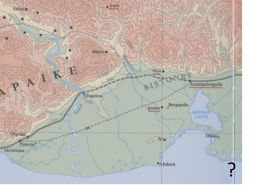
| Name (modern): | [near Xanthe?; unlocated] |
| Bild: | 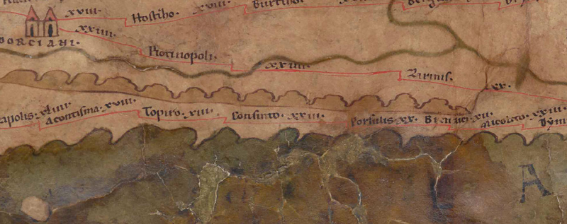 Zum Bildausschnitt auf der gesamten TP |
| Toponym vorher | XIII Topiro |
| Toponym nachher | XXIII Porsulis |
| Alternatives Bild | --- |
| Bild (Barrington 2000) |
 |
| Bild (Scheyb 1753) | --- |
| Bild (Welser 1598) | --- |
| Bild (MSI 2025) | --- |
| Pleiades: | https://pleiades.stoa.org/places/507391 |
| Großraum: | Balkanraum südlich |
| Toponym Typus: | Ortsname ohne Symbol |
| Planquadrat: | 7B4 |
| Farbe des Toponyms: | schwarz |
| Vignette Typus : | --- |
| Itinerar (ed. Cuntz): | Cosinto (321,4) |
| Alternativer Name (Lexika): |
|
| RE: | Kosintos |
| Barrington Atlas: | Cosinto (51 unlocated) |
| TIR / TIB /sonstiges: | Cosinto (TIR K 35/1, 23); Cosinto (TIB 6, 231f) |
| Miller: | Consinto |
| Levi: |
|
| Ravennat: | Cossimon (4,6 p. 48,29); Cositon (5,12 p. 93,3) |
| Ptolemaios (ed. Stückelberger / Grasshoff): | - |
| Plinius: |
|
| Strabo: |
|
| Autor (Hellenismus / Späte Republik): |
|
| Datierung des Toponyms auf der TP: | Spätantike (ab Diokletian & 4. Jh.) |
| Begründung zur Datierung: | Nur in den spätantiken Itineraren und ihren Kompilatoren erwähnt. |
| Kommentar zum Toponym: |
Namensform nur hier belegt. |
| Literatur: |
Kallintzi, Constantina: Η χώρα των Αβδήρων: συμβολή στην αρχαιολογία και ιστορική τοπογραφία του νότιου τμήματος του νομού Ξάνθης / The chora of Abdera: a contribution to the archaeology and historical topography of the south region of the prefecture of Xanthi, Bolos 2012. |
| Letzte Bearbeitung: | 16.05.2025 17:44 |
Cite this page:
https://tp-online.ku.de/trefferanzeige.php?id=1139 [zuletzt aufgerufen am 18.05.2026]