deutsch englisch spanisch französisch italienisch
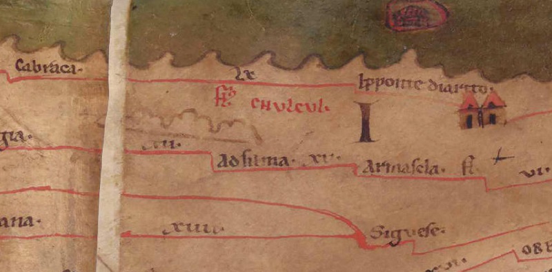
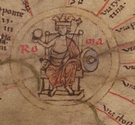
Ausschnitt aus der Tabula Peutingeriana - Rom

Tabula Peutingeriana – Display individuale

Toponimo TP (sciolto):

Fluvius Chvlcvl (Fluvius Chulcul)

Nome (moderno):

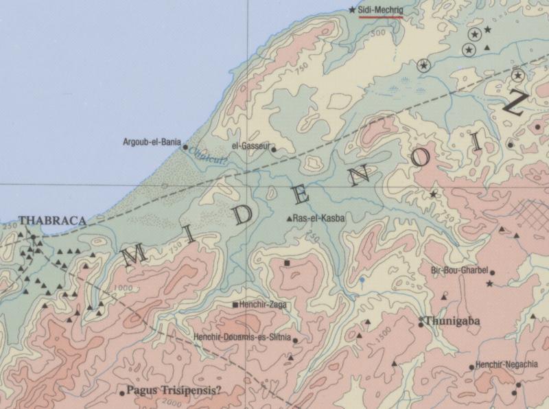
Oued-bou-Zenna (Barrington) / O. Endja (Miller)

Foglio:
Al dettaglio dell'immagine
Toponimo davanti
Toponimo dopo
Foglio alternativo: ---
Foglio (Barrington 2000)
Foglio (Scheyb 1753) ---
Foglio (Welser 1598) ---
Foglio (MSI 2025) ---
Pleiades: https://pleiades.stoa.org/places/314930
Area:

Africa Proconsolare

Tipo di toponimo:

fiume

Quadrato:

4C1

Colore di toponimo:

rosso

Tipo di vignetta:

---

Nome (Itinerario):


Nome alternativo (dizionari):


Nome (RE):

Muthul (?)

Nome (Barrington):

Chulcul? fl. (32 C2)

Nome (TIR / TIB /altro):


Nome (Miller):

Fl` Chulcul

Nome (Levi):


Nome (Ravennat):


Nome (Ptolemaios):


Plinius:


Strabo:


Datazione del toponimo sulla TP:

---

Giustificazione della datazione:


Commento al toponimo:

Kommentar (Talbert):
Since the river course is missing and the name is clear, no number is assigned.

The scanned image leaves the distinct impression that the copyist began to draw the river course to the sea from the righthand end of mountain range #32 below the name. He then realized that he had erred in starting below the mountain range, rather than above it (otherwise the river would need to flow over the mountains). So he erased what he had drawn; hence the two breaks in the mountain range, and the line of white extending between Fl. and Chvlcvl. But he never repaired the two breaks, nor made a further attempt to mark the river course.

Miller, Itineraria, Sp. 950:
Fl` Chulcul, nicht gezeichnet, nur der Name [nicht der bei Hippo Diaritos mündende, durch zwei Seen fließende Fluß, welcher Ubus heißt (s.u.), sondern der bei der Stadt Chulchul entspringende Nebenfluß des Ampsaga]; cf. Muthul fl. (Sall Jug c. 48), welcher die Gebiete des Jugurtha und Adherbal trennte; j. O. Endja. Mit den zwei Nebenflüssen [Caput Budelli] u. [Fons camerata].

Datierung (Barrington):
Chulcul? fl. – Roman/Late Antique (Salama 1951, 124)

RE:
Muthul Fluß Numidiens XVI.1 937-938 Oehler, R.

Kommentar (Köhner):
Ein ebenfalls nicht mit Flusslauf, sondern nur mit Namen eingezeichneter Fluss, dessen Lokalisation große Schwierigkeiten bereitet. Der Barrington Atlas verortet seine Mündung vorsichtig zwischen Thabraca und Hippo Diarrhytus (Chulcul? (BAtlas 32 C2)), was auch ungefähr seiner Lage auf der TP entspricht, wobei auch hier fraglich ist, ob nicht die TP das einzige Zeugnis für diesen Flusseintrag des Barrington Atlasses ist. MILLER verweist auf den schon genannten Muthul, der bei Sallust (Vgl. Sall. Iug. 48,3-50,2) als Grenzort der Gebiete des Iugurtha und des Adherbal genannt wird, jedoch laut diesem weit im Landesinneren entspringt und als rechter Nebenfluss in den Bagradas fließt (Vgl. HUß, Muthul, Sp. 559).

DNP:
Muthul

Fluß in Numidia, rechter Nebenfluß des Bagradas, wahrscheinlich der Oued Mellègue. Sall. Iug. 48,3-50,2.

Huß, Werner

Letteratura:

Miller, Itineraria, Sp. 950;

R. Oehler, s.v. M., RE 16, 937f.

Köhner, Nordafrika, S. 176.

   [Standard-Literatur-Liste im PDF-Format]

Ultima modifica:

27.08.2024 08:32


Cite this page:
https://tp-online.ku.de/trefferanzeige_it.php?id=2765 [zuletzt aufgerufen am 11.11.2026]

Impressum Datenschutzerklärung