deutsch englisch spanisch französisch italienisch
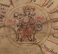
Ausschnitt aus der Tabula Peutingeriana - Rom

Tabula Peutingeriana – Pantalla individual

Topónimo (simplificado):

Diolindum

Nombre (moderno):

Lalinde

Imagen:
Al detalle de la imagen
Topónimo antes XXI     Excisum     
Topónimo después XXIIII     Bibona     
Imagen alternativa ---
Imagen (Barrington 2000)
Imagen (Scheyb 1753) ---
Imagen (Welser 1598) ---
Imagen (MSI 2025) ---
Área:

Galia/Germania

Tipo de topónimo:

Topónimo sin símbolo

Cuadrícula:

1B2

Color del topónimo:

negro

Tipo de viñeta:

---

Itinerario:


Nombres alternativos (diccionarios):


Nombre A (RE):

Diolindum

Nombre B (Barrington Atlas):

Diolindum? (14 F4)

Nombre C (TIR / TIB /otros):


Nombre D (Miller):

Diolindum

Nombre E (Levi):


Nombre F (Ravenate):


Nombre G (Ptolemaios):


Plinius:


Strabo:


Datación del topónimo en la TP:

---

Fundamento para la datación:


Comentario al topónimo:

Kommentar (Talbert):
-> stretch to Bibona
Placement of the distance figure below the route linework is untypical, and there is no knowing whether it originated with a copyist or with the mapmaker. The latter might have been expected to prefer the introduction of an additional chicane below the name so as to continue the route linework into the Bibona symbol under the distance figure.

Miller, Itineraria, Sp. 121:
Diolindum, wohl identisch mit Trajectus (It); j. La Linde.
24.

Datierung (Barrington):
Diolindum? – Roman/Late Antique (ItMiller 121; CAG 24/1.223)

RE:
Diolindum
RE Ihm V,1 814 — Diolindum, Stadt der Cadurei, nur in der Tab. Peut. erwähnt zwischen Bibona (= Divona, Cahors) und Aginnum (Agen). Desjardins Tab. Peut. 45; Geogr. de la Gaule II 422. Holder Altkelt. Sprachschatz s. v. [Ihm.]


"TP-Online-ID: 3182 — Diolindum

Desjardins S. 45.

Lesung und Namensform bei Desjardins: Diolindum; normalisierte Form: DIOLINDUM.

Lage und Route bei Desjardins: Region/Lage: Aquitania II. Typ: Carrefour de trois routes. Route/Abschnitt: LXII. de Lugduno, Lyon, — à Burdigala, Bordeaux; — par Segodum, Rodez; Bibona, Cahors, et Aginnum, Agen.

Quellenstellen bei Desjardins: keine Quellenstelle bei Desjardins angegeben.

Moderne Identifikation bei Desjardins: Unsicher: La Linde; alternativ Belvès, Duravel oder Puy-l’Évêque.

Kommentar und Forschungsstand bei Desjardins: Desjardins bemerkt, dass eine Distanz im Original versehentlich über der Strecke Bibona–Tolosa über Cosa steht. La Linde bei d’Anville, Notice de la Gaule, S. 270, Walckenaer III, S. 100, Reichard und Lapie S. 223; die Entfernung wäre dafür allerdings zu gering. Belvès bei Ukert II,2, S. 392; Duravel bei Commission; Puy-l’Évêque bei Katancsich I, S. 124. Auch bei letzterer Lösung müsste die Kartendistanz reduziert werden.

Zusatz aus Desjardins’ Gallien-/Germanienanalyse (S. 77–78): In der systematischen Einzelprüfung der Aquitania führt Desjardins diesen Namen unter den Ortsnamen, die er ausdrücklich als sicher vor dem Tod des Augustus bzw. spätestens augusteisch einstuft.

Bearbeitungshinweis: Keine antike Parallelquelle; Desjardins entscheidet nicht sicher für La Linde."

Bibliografía:

Desjardins, Table, p. 45, col. 3, no. 11.

Miller, Itineraria, Sp. 121.

Ihm, Maximilian, Diolindum, in: RE V/1 (1903), Sp. 814.

   [Standard-Literatur-Liste im PDF-Format]

Última elaboración:

24.08.2026 14:53


Cite this page:
https://tp-online.ku.de/trefferanzeige_es.php?id=3182 [zuletzt aufgerufen am 13.11.2026]

Derechos Política de privacidad