
Tabula Peutingeriana – Pantalla individual
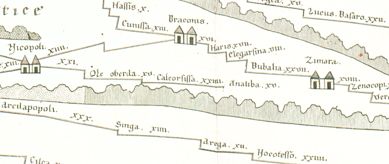
| Topónimo (simplificado): | Analiba |
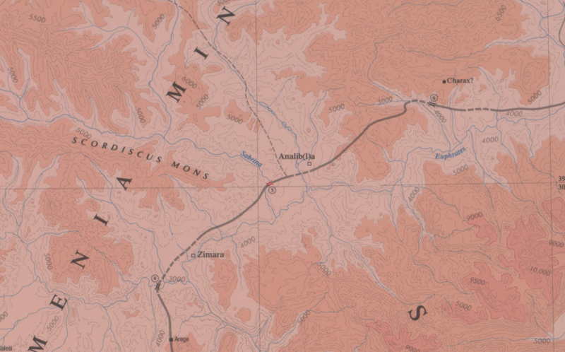
| Nombre (moderno): | ? Hasanova ? |
| Imagen: | 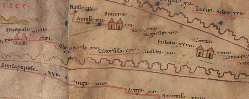 Al detalle de la imagen |
| Topónimo antes | XXIIII Caleorsissa |
| Topónimo después | XV Zimara |
| Imagen alternativa | --- |
| Imagen (Barrington 2000) |
 |
| Imagen (Scheyb 1753) |
 |
| Imagen (Welser 1598) | --- |
| Imagen (MSI 2025) | --- |
| Pleiades: | https://pleiades.stoa.org/places/628922 |
| Área: | Asia Menor |
| Tipo de topónimo: | Topónimo sin símbolo |
| Cuadrícula: | 10B1 |
| Color del topónimo: | negro |
| Tipo de viñeta: | --- |
| Itinerario: | Analiba (208,4) |
| Nombres alternativos (diccionarios): |
|
| Nombre A (RE): | Analiba |
| Nombre B (Barrington Atlas): | Analib(l)a (64 H1) |
| Nombre C (TIR / TIB /otros): |
|
| Nombre D (Miller): | Analiba |
| Nombre E (Levi): |
|
| Nombre F (Ravenate): |
|
| Nombre G (Ptolemaios): | Ἀνάλιβλα (5,7,4) |
| Plinius: |
|
| Strabo: |
|
| Datación del topónimo en la TP: | --- |
| Fundamento para la datación: | Belegt seit Ptol. und in spätantiken Quellen. |
| Comentario al topónimo: |
Lag in Wirklichkeit südöstl. der voraufgehenden Station Caleorissa und nordöstl. der Folgestation Zimara (heute: Pingan). Auf der TP liegt Analiba, anders als im ItAnt (s. u.), auf einer Verbindung von 9A5 Nicopoli nach Zimara (und zwar 15 Meilen vor Zimara), wahrscheinlich ein Irrtum, wie auch das Fehlen der roten Straßenlinie nahelegt (s. Mitford 2018, vol. 1, 257). |
| Bibliografía: |
Bryer, A. A. M./Winfield, D. C.: The Byzantine monuments and topography of the Pontos, 2 Bde., Washington DC 1985, 25; 31f. |
| Última elaboración: | 20.09.2025 16:53 |
Cite this page:
https://tp-online.ku.de/trefferanzeige_es.php?id=1671 [zuletzt aufgerufen am 18.04.2026]