
Tabula Peutingeriana – Pantalla individual
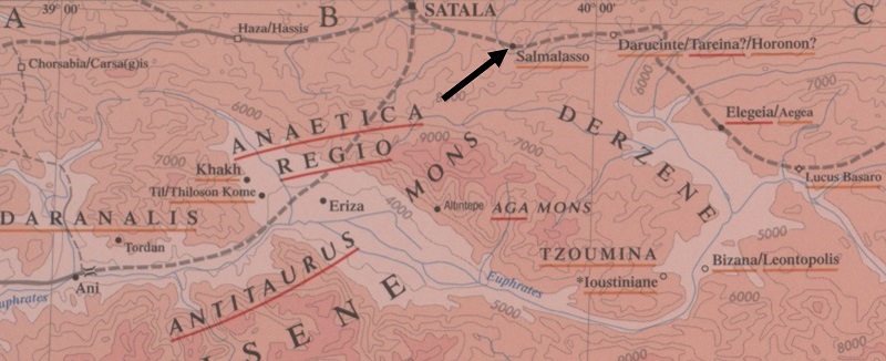
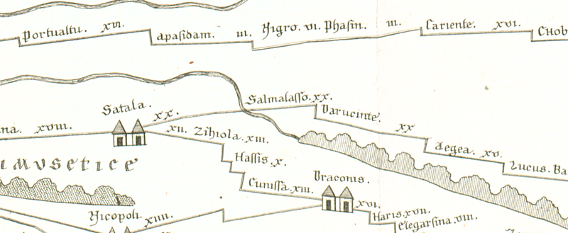
| Topónimo (simplificado): | Salmalasso |
| Nombre (moderno): | ? Gelengeç ? Lori ? |
| Imagen: | 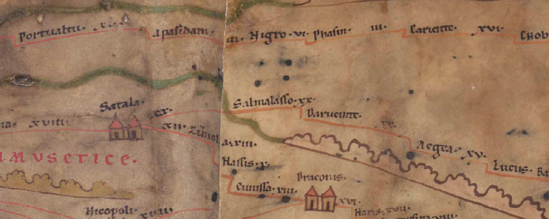 Al detalle de la imagen |
| Topónimo antes | XX Satala |
| Topónimo después | XX Darucinte |
| Imagen alternativa | --- |
| Imagen (Barrington 2000) |
 |
| Imagen (Scheyb 1753) |
 |
| Imagen (Welser 1598) | --- |
| Imagen (MSI 2025) | --- |
| Pleiades: | https://pleiades.stoa.org/places/874672 |
| Área: | Asia Menor |
| Tipo de topónimo: | Topónimo sin símbolo |
| Cuadrícula: | 10A1 |
| Color del topónimo: | negro |
| Tipo de viñeta: | --- |
| Itinerario: |
|
| Nombres alternativos (diccionarios): |
|
| Nombre A (RE): |
|
| Nombre B (Barrington Atlas): | Salmalasso (89 B1) |
| Nombre C (TIR / TIB /otros): |
|
| Nombre D (Miller): | Salmalasso |
| Nombre E (Levi): |
|
| Nombre F (Ravenate): |
|
| Nombre G (Ptolemaios): |
|
| Plinius: |
|
| Strabo: |
|
| Datación del topónimo en la TP: | --- |
| Fundamento para la datación: |
|
| Comentario al topónimo: |
Lag in Wirklichkeit südöstl. der vorangehenden Station Satala. |
| Bibliografía: |
Bryer, A. A. M./Winfield, D. C.: The Byzantine monuments and topography of the Pontos, 2 Bde., Washington DC 1985, 1, 34f. |
| Última elaboración: | 20.09.2025 15:45 |
Cite this page:
https://tp-online.ku.de/trefferanzeige_es.php?id=1599 [zuletzt aufgerufen am 19.04.2026]