
Tabula Peutingeriana – Pantalla individual
| Topónimo (simplificado): | Danae |
| Nombre (moderno): | ? Kündür |
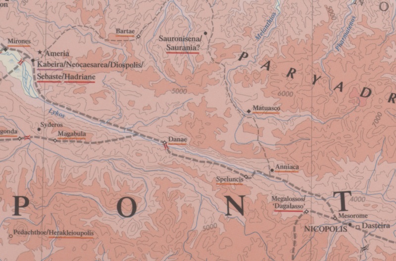
| Imagen: | 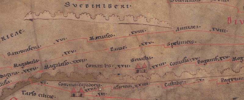 Al detalle de la imagen |
| Topónimo antes | XXV Magabula |
| Topónimo después | XXV Speluncis |
| Imagen alternativa | --- |
| Imagen (Barrington 2000) |
 |
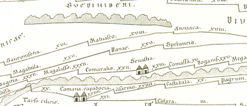
| Imagen (Scheyb 1753) |
 |
| Imagen (Welser 1598) | --- |
| Imagen (MSI 2025) | --- |
| Pleiades: | https://pleiades.stoa.org/places/857102 |
| Área: | Asia Menor |
| Tipo de topónimo: | Topónimo sin símbolo |
| Cuadrícula: | 9A4 |
| Color del topónimo: | negro |
| Tipo de viñeta: | --- |
| Itinerario: |
|
| Nombres alternativos (diccionarios): |
|
| Nombre A (RE): | Danaë 1 |
| Nombre B (Barrington Atlas): | Danae (87 C4) |
| Nombre C (TIR / TIB /otros): |
|
| Nombre D (Miller): | Danae |
| Nombre E (Levi): |
|
| Nombre F (Ravenate): |
|
| Nombre G (Ptolemaios): | Δανάη (var. lect. Δάνατι) (5,6,10) |
| Plinius: |
|
| Strabo: |
|
| Datación del topónimo en la TP: | Período Imperial (siglo segundo) |
| Fundamento para la datación: | Sonst nur noch belegt bei Ptol. |
| Comentario al topónimo: |
Gleiche Namensform: |
| Bibliografía: |
Bryer, A. A. M./Winfield, D. C.: The Byzantine monuments and topography of the Pontos, 2 Bde., Washington DC 1985, 23f. |
| Última elaboración: | 18.08.2025 17:18 |
Cite this page:
https://tp-online.ku.de/trefferanzeige_es.php?id=1383 [zuletzt aufgerufen am 19.04.2026]