
Tabula Peutingeriana – Single display of hits
| Toponym TP (renewed): | Ocrocenaurio |
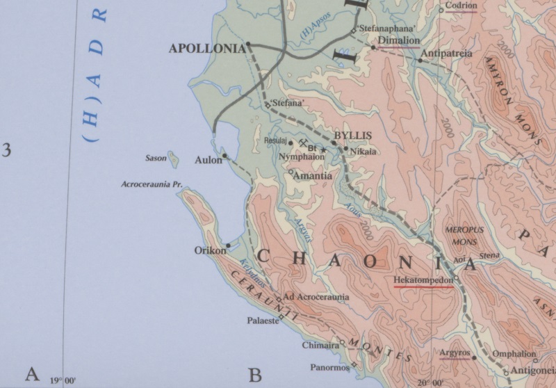
| Name (modern): | near Llogara Pass [Barrington] |
| Image: | 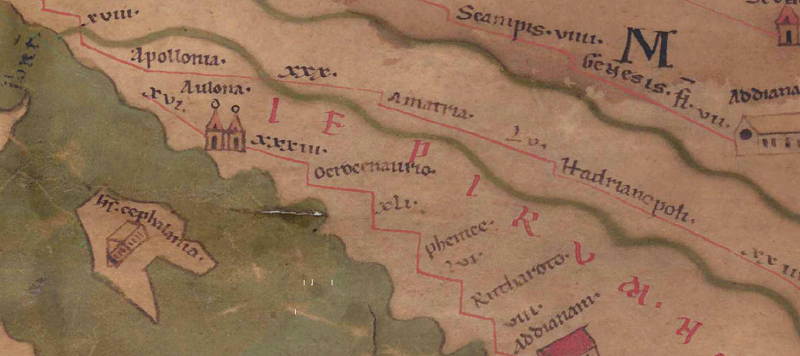 To the image detail |
| Toponym before | XXXIII Aulona |
| Toponym following | XLI Phenice |
| Alternative Image | --- |
| Image (Barrington 2000) |
 |
| Image (Scheyb 1753) | --- |
| Image (Welser 1598) | --- |
| Image (MSI 2025) | --- |
| Pleiades: | https://pleiades.stoa.org/places/481694 |
| Area: | Southern Balkans |
| Toponym Type: | Toponym, no Symbol |
| Grid square: | 6B3 |
| Toponym Color: | black |
| Vignette Type : | --- |
| Itinerary: | Acroceraunia (324,3) |
| Alternative Name (Lexica): |
|
| Name A (RE): |
|
| Name B (Barrington Atlas): | Ad Acroceraunia (49 B3) |
| Name C (TIR/TIB/others): | Ad Acroceraunia (TIR K 34, 11) |
| Name D (Miller): | Ocrocenaurio |
| Name E (Levi): |
|
| Name F (Ravennate): | Acroceaurion (5,13 p. 94,35) |
| Name G (Ptolemy): |
|
| Plinius: |
|
| Strabo: |
|
| Dating from Toponym on TP: | Roman Imperial Period (Severan dynasty and 3rd century |
| Argument for Dating: | Frühester Beleg der Straßenstation im ItAnt 324,3. |
| Commentary on the Toponym: |
Ocrocenaurio (Abl. separativus) ist eine Verschreibung aus Acroceraunio (bzw. Ad Acroceraunia). |
| References: |
Hammond, Nicholas: Epirus: the geography, the ancient remains, the history and the topography of Epirus and adjacent areas, Oxford 1967, 690f. |
| Last Update: | 22.10.2025 15:47 |
Cite this page:
https://tp-online.ku.de/trefferanzeige_en.php?id=937 [last accessed on June 27, 2026]