
Tabula Peutingeriana – Single display of hits
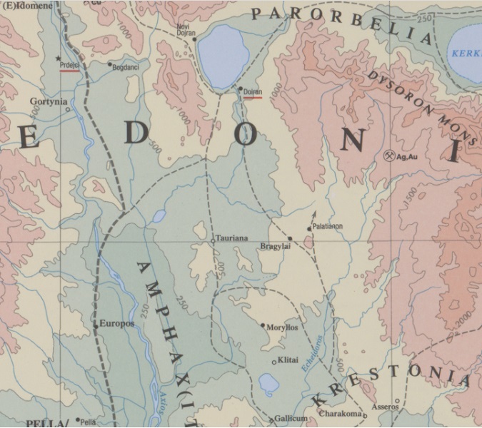
| Toponym TP (renewed): | Tauriana |
| Name (modern): | Chorygi ? |
| Image: | 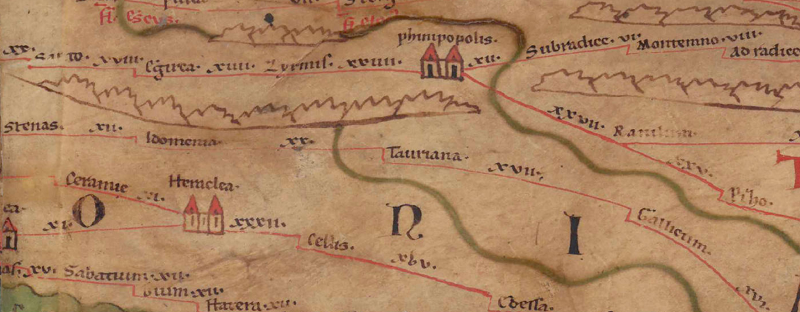 To the image detail |
| Toponym before | XX Idomenia |
| Toponym following | XVII Gallicum |
| Alternative Image | --- |
| Image (Barrington 2000) |
 |
| Image (Scheyb 1753) | --- |
| Image (Welser 1598) | --- |
| Image (MSI 2025) | --- |
| Pleiades: | https://pleiades.stoa.org/places/491737 |
| Area: | Southern Balkans |
| Toponym Type: | Toponym, no Symbol |
| Grid square: | 7B1 |
| Toponym Color: | black |
| Vignette Type : | --- |
| Itinerary: |
|
| Alternative Name (Lexica): |
|
| Name A (RE): |
|
| Name B (Barrington Atlas): | Tauriana (50 C2) |
| Name C (TIR/TIB/others): |
|
| Name D (Miller): | Tauriana |
| Name E (Levi): |
|
| Name F (Ravennate): | Tauriana (p. 51,36) |
| Name G (Ptolemy): |
|
| Plinius: |
|
| Strabo: |
|
| Dating from Toponym on TP: | Late Antiquity (from Diocletian and 4th century) |
| Argument for Dating: | Ort nur über die gemeinsame spätantike Vorlage von TP und Rav greifbar. |
| Commentary on the Toponym: |
Station an der Via Axia, wohl relativ spät zu verkehrstechnischen Zwecken gegründet, wie auch die folgende Station 7B2 Gallicum (s. Hatzopoulos/Loukopoulou 1989, 104). |
| References: |
Grčić, Mirko: Putevi i naseljena mesta zapadnog Balkana na Pojtingerovoj tabli-itineraru / West Balkan roads and settlements on Peutinger´s map-itinerary, Насловна 21 (2017), 17-37. |
| Last Update: | 22.10.2025 14:27 |
Cite this page:
https://tp-online.ku.de/trefferanzeige_en.php?id=910 [last accessed on June 25, 2026]