
Tabula Peutingeriana – Single display of hits
| Toponym TP (renewed): | Nalata (Halata) |
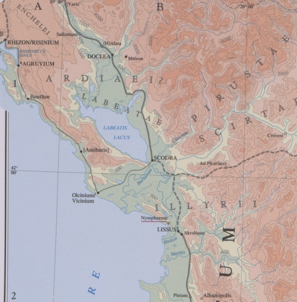
| Name (modern): | Spuž? |
| Image: | 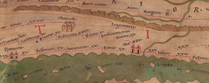 To the image detail |
| Toponym before | XVIII Sallunto |
| Toponym following | X Bersumno |
| Alternative Image | --- |
| Image (Barrington 2000) |
 |
| Image (Scheyb 1753) | --- |
| Image (Welser 1598) | --- |
| Image (MSI 2025) | --- |
| Pleiades: | https://pleiades.stoa.org/places/481855 |
| Area: | Northern Balkans |
| Toponym Type: | Toponym, no Symbol |
| Grid square: | 6A1 |
| Toponym Color: | black |
| Vignette Type : | --- |
| Itinerary: | Alata (339,1) |
| Alternative Name (Lexica): |
|
| Name A (RE): | Alata [1] - https://elexikon.ch/RE/I,1_1293.png |
| Name B (Barrington Atlas): | (H)Alata (49 B1) |
| Name C (TIR/TIB/others): | Alata (TIR K 34,13) |
| Name D (Miller): | Nalata |
| Name E (Levi): |
|
| Name F (Ravennate): | Aleta (4,16 p. 55,6) |
| Name G (Ptolemy): | Ἄλητα (2,16,11) |
| Plinius: |
|
| Strabo: |
|
| Dating from Toponym on TP: | --- |
| Argument for Dating: |
|
| Commentary on the Toponym: |
Zur Transskription: |
| References: |
Miller, Itineraria, Sp. 469. |
| Last Update: | 04.01.2026 17:40 |
Cite this page:
https://tp-online.ku.de/trefferanzeige_en.php?id=870 [last accessed on June 26, 2026]