
Tabula Peutingeriana – Single display of hits
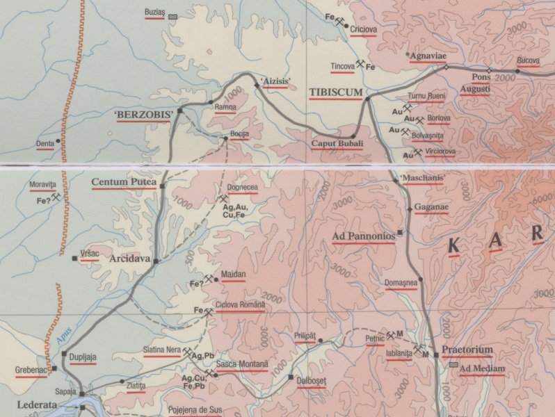
| Toponym TP (renewed): | Tivisco |
| Name (modern): | Jupa |
| Image: | 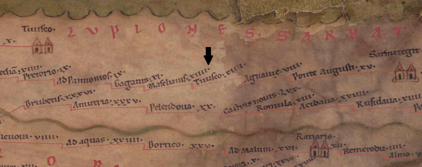 To the image detail |
| Toponym before | XIIII Masclianis |
| Toponym following | XIIII Agnaviae |
| Alternative Image | --- |
| Image (Barrington 2000) |
 |
| Image (Scheyb 1753) | --- |
| Image (Welser 1598) | --- |
| Image (MSI 2025) | --- |
| Pleiades: | https://pleiades.stoa.org/places/207495 |
| Area: | Northern Balkans |
| Toponym Type: | Toponym, no Symbol |
| Grid square: | 6A4 |
| Toponym Color: | black |
| Vignette Type : | --- |
| Itinerary: |
|
| Alternative Name (Lexica): | Tibiscum (DNP) |
| Name A (RE): | Tibiscum - https://elexikon.ch/RE/VIA,1_813.png |
| Name B (Barrington Atlas): | Tibiscum (21 E4) |
| Name C (TIR/TIB/others): |
|
| Name D (Miller): | Tivisco |
| Name E (Levi): |
|
| Name F (Ravennate): |
|
| Name G (Ptolemy): | Τίβισκον (3,8,10) |
| Plinius: |
|
| Strabo: |
|
| Dating from Toponym on TP: | --- |
| Argument for Dating: |
|
| Commentary on the Toponym: |
Kommentar (Talbert): |
| References: |
Miller, Itineraria, Sp. 547. |
| Last Update: | 14.06.2025 14:34 |
Cite this page:
https://tp-online.ku.de/trefferanzeige_en.php?id=804 [last accessed on June 27, 2026]