
Tabula Peutingeriana – Single display of hits
| Toponym TP (renewed): | Liuiana (Liviana) |
| Name (modern): | (13 miles E Thamugadi) (Barrington) |
| Image: | 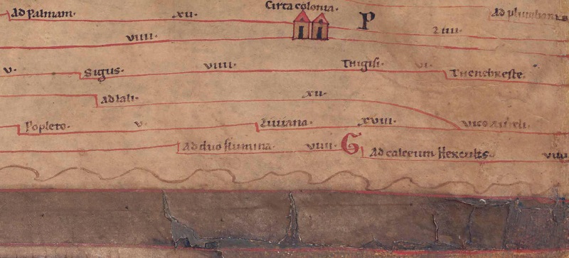 To the image detail |
| Toponym before | V Popleto |
| Toponym following | XVIII Vicus Aureli |
| Alternative Image | --- |
| Image (Barrington 2000) | --- |
| Image (Scheyb 1753) | --- |
| Image (Welser 1598) | --- |
| Image (MSI 2025) | --- |
| Pleiades: | https://pleiades.stoa.org/places/338274 |
| Area: | Numidia |
| Toponym Type: | Toponym, no Symbol |
| Grid square: | 2C5 |
| Toponym Color: | black |
| Vignette Type : | --- |
| Itinerary: |
|
| Alternative Name (Lexica): |
|
| Name A (RE): | Liviana [2] |
| Name B (Barrington Atlas): | Liviana (34 unlocated) |
| Name C (TIR/TIB/others): |
|
| Name D (Miller): | Liuiana |
| Name E (Levi): |
|
| Name F (Ravennate): | Libiana (p. 39.40) |
| Name G (Ptolemy): |
|
| Plinius: |
|
| Strabo: |
|
| Dating from Toponym on TP: | --- |
| Argument for Dating: |
|
| Commentary on the Toponym: |
Miller, Itineraria, Sp. 925: |
| References: |
Miller, Itineraria, Sp. 925; |
| Last Update: | 31.12.2024 01:26 |
Cite this page:
https://tp-online.ku.de/trefferanzeige_en.php?id=796 [last accessed on June 27, 2026]