
Tabula Peutingeriana – Single display of hits
| Toponym TP (renewed): | Risca |
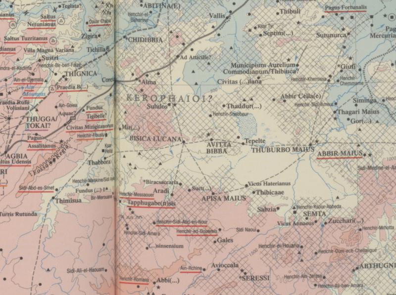
| Name (modern): | Henchir-Bichga |
| Image: | 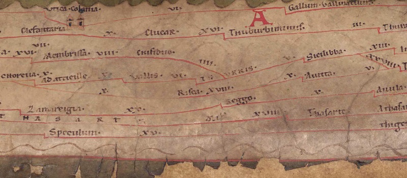 To the image detail |
| Toponym before | X Choreva |
| Toponym following | X Sicilibra XVIII Avitta |
| Alternative Image | --- |
| Image (Barrington 2000) |
 |
| Image (Scheyb 1753) | --- |
| Image (Welser 1598) | --- |
| Image (MSI 2025) | --- |
| Pleiades: | https://pleiades.stoa.org/places/314908 |
| Area: | Africa Proconsularis |
| Toponym Type: | Toponym, no Symbol |
| Grid square: | 4C4 |
| Toponym Color: | black |
| Vignette Type : | --- |
| Itinerary: |
|
| Alternative Name (Lexica): |
|
| Name A (RE): | Bisica |
| Name B (Barrington Atlas): | Bisica Lucana (32 E4) |
| Name C (TIR/TIB/others): |
|
| Name D (Miller): | Risca |
| Name E (Levi): |
|
| Name F (Ravennate): |
|
| Name G (Ptolemy): |
|
| Plinius: |
|
| Strabo: |
|
| Dating from Toponym on TP: | --- |
| Argument for Dating: |
|
| Commentary on the Toponym: |
[PK: Verbindungsstrich nach Sicillaba fehlt, Distanzangabe (X) jedoch vorhanden, aber falsch platziert.] |
| References: |
Miller, Itineraria, Sp. 932; |
| Last Update: | 26.02.2025 15:46 |
Cite this page:
https://tp-online.ku.de/trefferanzeige_en.php?id=436 [last accessed on June 28, 2026]