
Tabula Peutingeriana – Single display of hits
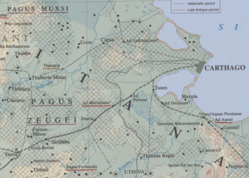
| Toponym TP (renewed): | Ad Pertusa |
| Name (modern): | el Harairia |
| Image: | 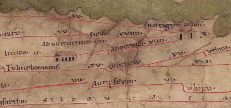 To the image detail |
| Toponym before | IIII Ad Mercurium |
| Toponym following | XIIII Carthagine Colonia |
| Alternative Image | --- |
| Image (Barrington 2000) |
 |
| Image (Scheyb 1753) | --- |
| Image (Welser 1598) | --- |
| Image (MSI 2025) | --- |
| Pleiades: | https://pleiades.stoa.org/places/314853 |
| Area: | Africa Proconsularis |
| Toponym Type: | Toponym, no Symbol |
| Grid square: | 4C5 |
| Toponym Color: | black |
| Vignette Type : | --- |
| Itinerary: | Pertusa (45,6) |
| Alternative Name (Lexica): |
|
| Name A (RE): | Pertusa 2 |
| Name B (Barrington Atlas): | Ad Pertusa (32 F3) |
| Name C (TIR/TIB/others): |
|
| Name D (Miller): | Ad pertusa |
| Name E (Levi): |
|
| Name F (Ravennate): | Ad pertusa (p. 37.52) |
| Name G (Ptolemy): |
|
| Plinius: |
|
| Strabo: |
|
| Dating from Toponym on TP: | --- |
| Argument for Dating: |
|
| Commentary on the Toponym: |
Miller, Itineraria, Sp. 933f.: |
| References: | Miller, Itineraria, Sp. 933f.; [Standard-Literatur-Liste im PDF-Format] |
| Last Update: | 26.02.2025 15:35 |
Cite this page:
https://tp-online.ku.de/trefferanzeige_en.php?id=424 [last accessed on June 27, 2026]