
Tabula Peutingeriana – Single display of hits
| Toponym TP (renewed): | Vallio |
| Name (modern): | Toul |
| Image: | 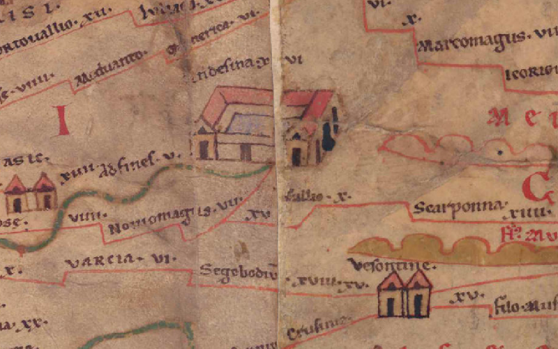 To the image detail |
| Toponym before | XV (?) Nouiomagus (Noviomagus) |
| Toponym following | X Scarponna |
| Alternative Image | --- |
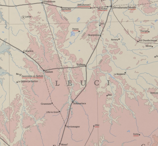
| Image (Barrington 2000) |
 |
| Image (Scheyb 1753) | --- |
| Image (Welser 1598) | --- |
| Image (MSI 2025) | --- |
| Pleiades: | https://pleiades.stoa.org/places/109396 |
| Area: | Gaul/Germania |
| Toponym Type: | Toponym, no Symbol |
| Grid square: | 1A5 / 2A1 |
| Toponym Color: | black |
| Vignette Type : | --- |
| Itinerary: | Tullum (365,4) |
| Alternative Name (Lexica): | Tullum (DNP) |
| Name A (RE): | Tullum (Tullium) Leucorum - http://elexikon.ch/RE/VIIA,2_1337.png |
| Name B (Barrington Atlas): | Tullum (11 F4) |
| Name C (TIR/TIB/others): |
|
| Name D (Miller): | Tullio |
| Name E (Levi): |
|
| Name F (Ravennate): |
|
| Name G (Ptolemy): | Τοῦλλον (Τούλλιον) (2,9,13) |
| Plinius: |
|
| Strabo: |
|
| Dating from Toponym on TP: | --- |
| Argument for Dating: |
|
| Commentary on the Toponym: |
Kommentar (Talbert): |
| References: |
Desjardins, Table, p. 19, col. 1, no. 2. |
| Last Update: | 07.01.2026 17:58 |
Cite this page:
https://tp-online.ku.de/trefferanzeige_en.php?id=3370 [last accessed on June 24, 2026]