
Tabula Peutingeriana – Single display of hits
| Toponym TP (renewed): | Statule |
| Name (modern): | westlich von Goriano Sicoli [3] |
| Image: | 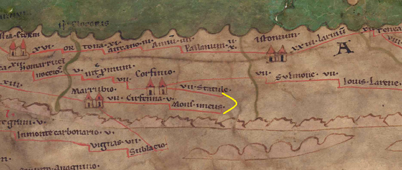 To the image detail |
| Toponym before | VII Corfinio |
| Toponym following | - Mons Imeus |
| Alternative Image |
 |
| Image (Barrington 2000) |
 |
| Image (Scheyb 1753) | --- |
| Image (Welser 1598) | --- |
| Image (MSI 2025) | --- |
| Pleiades: | https://pleiades.stoa.org/places/413322 |
| Area: | Italy |
| Toponym Type: | Toponym, no Symbol |
| Grid square: | 5B2 |
| Toponym Color: | black |
| Vignette Type : | --- |
| Itinerary: |
|
| Alternative Name (Lexica): |
|
| Name A (RE): | Statulae - https://elexikon.ch/RE/IIIA,2_2233.png |
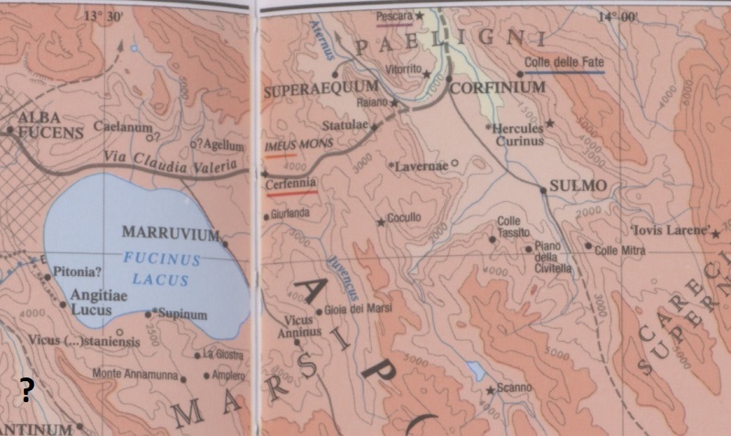
| Name B (Barrington Atlas): | Statulae (42 F4) |
| Name C (TIR/TIB/others): |
|
| Name D (Miller): | Statule |
| Name E (Levi): |
|
| Name F (Ravennate): |
|
| Name G (Ptolemy): |
|
| Plinius: |
|
| Strabo: |
|
| Dating from Toponym on TP: | yet indeterminable |
| Argument for Dating: | Fehlende literarische oder epigraphische Belege. |
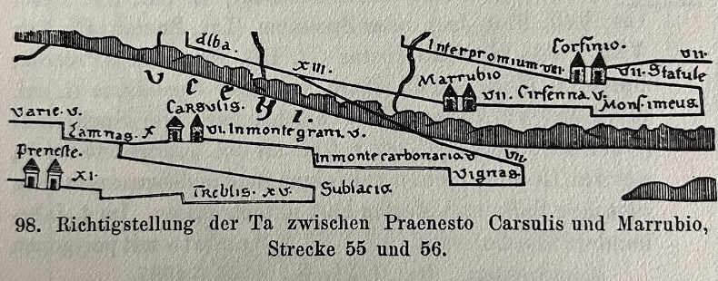
| Commentary on the Toponym: |
[PK: warum endet die Strecke im Nichts mit einem Haken, eigentlich müsste es weiter gehen nach Mons imeus laut BAtlas]. |
| References: |
[1] Cuntz, Topographische Studien |
| Last Update: | 26.10.2025 19:03 |
Cite this page:
https://tp-online.ku.de/trefferanzeige_en.php?id=333 [last accessed on June 25, 2026]