
Tabula Peutingeriana – Single display of hits
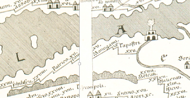
| Toponym TP (renewed): | Monogami |
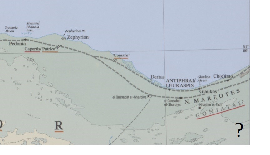
| Name (modern): | el-Qasaba el-Garbiya? (Barrington) |
| Image: | 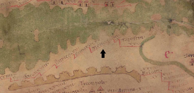 To the image detail |
| Toponym before | XV Comarv (Comaru) |
| Toponym following | - (unnamed / illegible no. DD) |
| Alternative Image | --- |
| Image (Barrington 2000) |
 |
| Image (Scheyb 1753) |
 |
| Image (Welser 1598) | --- |
| Image (MSI 2025) | --- |
| Pleiades: | https://pleiades.stoa.org/places/718033 |
| Area: | Egypt/Nile/Ethiopia |
| Toponym Type: | Toponym, no Symbol |
| Grid square: | 8C3 |
| Toponym Color: | black |
| Vignette Type : | --- |
| Itinerary: |
|
| Alternative Name (Lexica): |
|
| Name A (RE): | Monokaminon |
| Name B (Barrington Atlas): | Monokaminon/Monogami (73 unlocated) |
| Name C (TIR/TIB/others): |
|
| Name D (Miller): | Monogami |
| Name E (Levi): |
|
| Name F (Ravennate): | °Monocanon (p. 35.63), Monocaminon (p. 90.06) |
| Name G (Ptolemy): | Μομοκάμινον (4,5,34) |
| Plinius: |
|
| Strabo: |
|
| Dating from Toponym on TP: | Roman Imperial Period (2nd century) |
| Argument for Dating: | Der Eintrag ist am ehesten in die Hohe Kaiserzeit zu datieren, der Ort ist allerdings sehr schwach bezeugt. |
| Commentary on the Toponym: |
Monogami liegt ebenso wie Taposiris im Nomos Mareotis. Es liegt ca. 80 km westlich von Alexandria. Es handelt sich offenbar um eine eher kleinere Station an der Route von Alexandria über Taposiris in die westafrikanischen Provinzen. In der älteren Forschung wird das Toponym auch mit dem Platz Χειμῶ κώμη (Ptol. 4, 5, 8) bzw. Chimo vico in Verbindung gebracht (Katančić, Orbis antiquus II, 597) und indirekt auch Miller, der das westlich von Taposiris anzusetzende Chi als Chimo lesen will (Stad. mar. magn. 5, 6 = Geogr. Gr. min. I, 430f.); Sethe spricht jedoch zurückhaltend von einem „an der Küste des mareotischen Gaus“ gelegenen Ort (Sethe, in: RE III/2, 2205). Nach Grasshoff / Stückelberger (Klaudios Ptolemaios 1, 431) ist der Ort mit dem heutigen El-Qasaba el-Gharbiya gleichzusetzen. - Vgl. auch zu Tapostri·. |
| References: |
Miller, Itineraria, Sp. 872; |
| Last Update: | 18.02.2025 14:57 |
Cite this page:
https://tp-online.ku.de/trefferanzeige_en.php?id=2788 [last accessed on July 5, 2026]