
Tabula Peutingeriana – Single display of hits
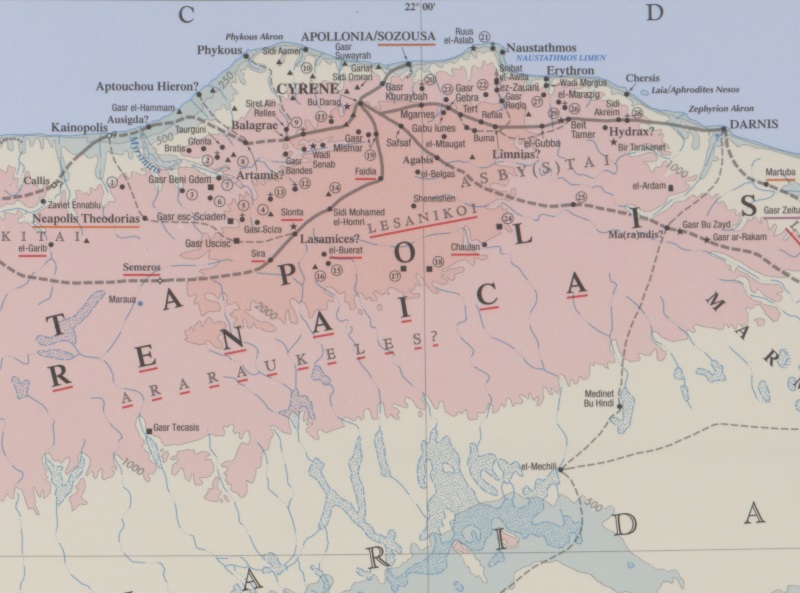
| Toponym TP (renewed): | Agabis |
| Name (modern): | el-Ghegab (Barrington) |
| Image: | 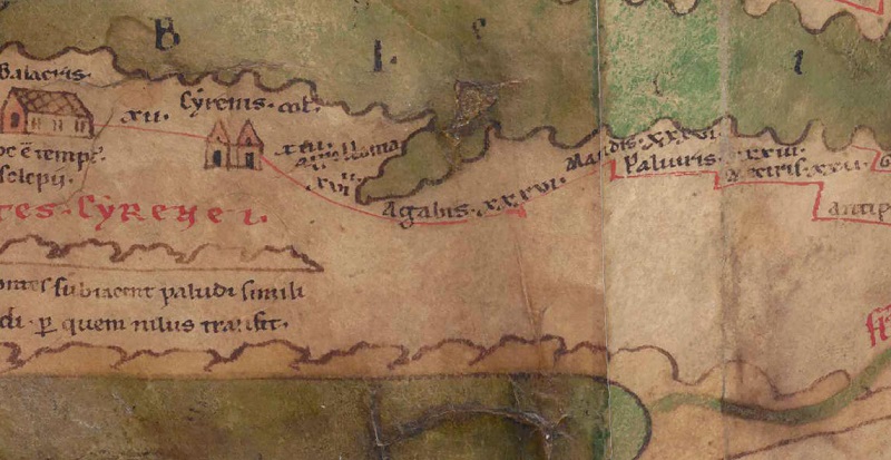 To the image detail |
| Toponym before | XVIII Cyrenis Colonia |
| Toponym following | XXXVI Mandis |
| Alternative Image | --- |
| Image (Barrington 2000) |
 |
| Image (Scheyb 1753) | --- |
| Image (Welser 1598) | --- |
| Image (MSI 2025) | --- |
| Pleiades: | https://pleiades.stoa.org/places/373727 |
| Area: | Cyrenaica |
| Toponym Type: | Toponym, no Symbol |
| Grid square: | 7C5 |
| Toponym Color: | black |
| Vignette Type : | --- |
| Itinerary: |
|
| Alternative Name (Lexica): |
|
| Name A (RE): |
|
| Name B (Barrington Atlas): | Agabis (38 D1) |
| Name C (TIR/TIB/others): |
|
| Name D (Miller): | Agabis |
| Name E (Levi): |
|
| Name F (Ravennate): | Agabus (p. 36.06), Agabis (p. 36.47; 89.43; 89.46; 90.27) |
| Name G (Ptolemy): | Ἀκαβίς (4,4,12) |
| Plinius: |
|
| Strabo: |
|
| Dating from Toponym on TP: | --- |
| Argument for Dating: |
|
| Commentary on the Toponym: |
Kommentar (Talbert): |
| References: |
Miller, Itineraria, Sp. 875; |
| Last Update: | 31.12.2024 01:06 |
Cite this page:
https://tp-online.ku.de/trefferanzeige_en.php?id=2699 [last accessed on July 1, 2026]