
Tabula Peutingeriana – Single display of hits
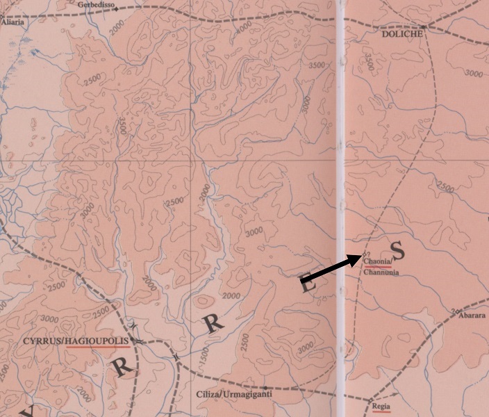
| Toponym TP (renewed): | Channunia |
| Name (modern): |
|
| Image: | 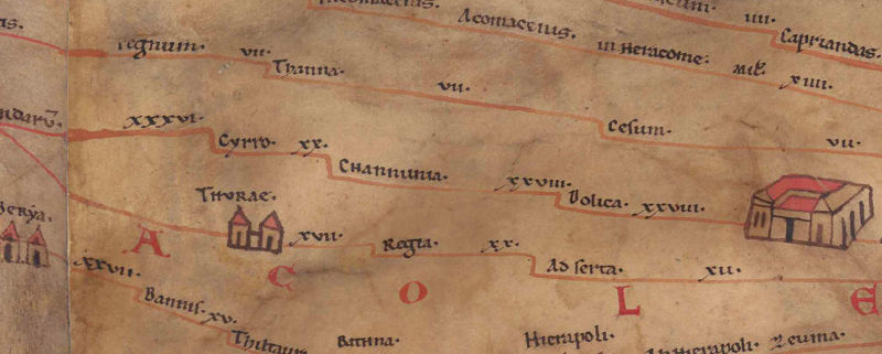 To the image detail |
| Toponym before | XX Cyrro |
| Toponym following | XXVIII Dolica |
| Alternative Image | --- |
| Image (Barrington 2000) |
 |
| Image (Scheyb 1753) | --- |
| Image (Welser 1598) | --- |
| Image (MSI 2025) | --- |
| Pleiades: | https://pleiades.stoa.org/places/658433 |
| Area: | Syria/Palestine/Arabia |
| Toponym Type: | Toponym, no Symbol |
| Grid square: | 10B1 |
| Toponym Color: | black |
| Vignette Type : | --- |
| Itinerary: | (194,8 Hanunea) |
| Alternative Name (Lexica): |
|
| Name A (RE): | Chaonia [2] - https://elexikon.ch/RE/III,2_2113.png |
| Name B (Barrington Atlas): | Chaonia (67 E3) |
| Name C (TIR/TIB/others): |
|
| Name D (Miller): | Channunia |
| Name E (Levi): |
|
| Name F (Ravennate): |
|
| Name G (Ptolemy): |
|
| Plinius: |
|
| Strabo: |
|
| Dating from Toponym on TP: | --- |
| Argument for Dating: |
|
| Commentary on the Toponym: |
Miller, Itineraria, Sp. 764: |
| References: |
Miller, Itineraria, Sp. 764; |
| Last Update: | 25.01.2026 18:08 |
Cite this page:
https://tp-online.ku.de/trefferanzeige_en.php?id=1700 [last accessed on July 27, 2026]