
Tabula Peutingeriana – Single display of hits
| Toponym TP (renewed): | Ad Mercurium |
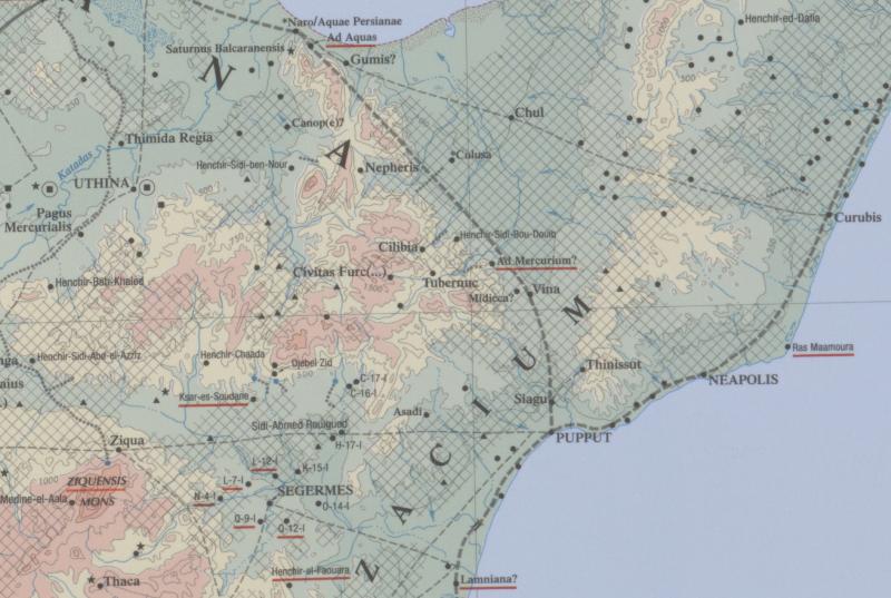
| Name (modern): | Beled-Djedeida (Barrington) / östl. v. Soliman bei Menzel bu Zalfa (Miller) |
| Image: | 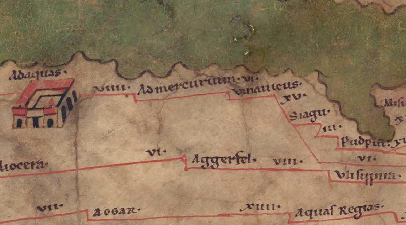 To the image detail |
| Toponym before | VIIII Ad Aquas |
| Toponym following | VI Vina Vicus |
| Alternative Image | --- |
| Image (Barrington 2000) |
 |
| Image (Scheyb 1753) | --- |
| Image (Welser 1598) | --- |
| Image (MSI 2025) | --- |
| Pleiades: | https://pleiades.stoa.org/places/314851 |
| Area: | Africa Proconsularis |
| Toponym Type: | Toponym, no Symbol |
| Grid square: | 5C1 |
| Toponym Color: | black |
| Vignette Type : | --- |
| Itinerary: |
|
| Alternative Name (Lexica): |
|
| Name A (RE): |
|
| Name B (Barrington Atlas): | Ad Mercurium? (32 G3) |
| Name C (TIR/TIB/others): |
|
| Name D (Miller): | Ad mercurium |
| Name E (Levi): |
|
| Name F (Ravennate): |
|
| Name G (Ptolemy): |
|
| Plinius: |
|
| Strabo: |
|
| Dating from Toponym on TP: | --- |
| Argument for Dating: |
|
| Commentary on the Toponym: |
Miller, Itineraria, Sp. 907: |
| References: | Miller, Itineraria, Sp. 907; [Standard-Literatur-Liste im PDF-Format] |
| Last Update: | 08.08.2024 15:05 |
Cite this page:
https://tp-online.ku.de/trefferanzeige_en.php?id=1550 [last accessed on June 28, 2026]