
Tabula Peutingeriana – Single display of hits
| Toponym TP (renewed): | Brenzici |
| Name (modern): | W Komotine |
| Image: | 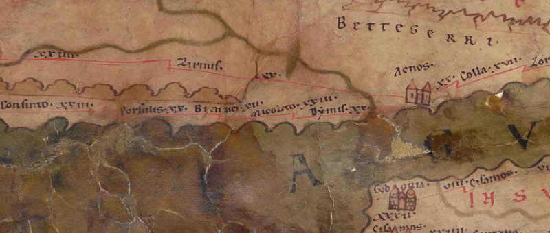 To the image detail |
| Toponym before | XX Porsulis |
| Toponym following | XII Micolito |
| Alternative Image | --- |
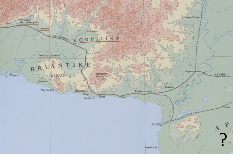
| Image (Barrington 2000) |
 |
| Image (Scheyb 1753) | --- |
| Image (Welser 1598) | --- |
| Image (MSI 2025) | --- |
| Pleiades: | https://pleiades.stoa.org/places/507380 |
| Area: | Northern Balkans |
| Toponym Type: | Toponym, no Symbol |
| Grid square: | 7B4 |
| Toponym Color: | black |
| Vignette Type : | --- |
| Itinerary: | Brendice (322,1) |
| Alternative Name (Lexica): |
|
| Name A (RE): | Brendice |
| Name B (Barrington Atlas): | Brendike (51 unlocated) |
| Name C (TIR/TIB/others): | Brendice (TIR K 35/1, 22); Brendice (TIB 6, 219f) |
| Name D (Miller): | Brenzici |
| Name E (Levi): |
|
| Name F (Ravennate): | Brentice (4,6 p. 48,28); Brindice (5,12 p. 93,34) |
| Name G (Ptolemy): | - |
| Plinius: |
|
| Strabo: |
|
| Dating from Toponym on TP: | Late Antiquity (from Diocletian and 4th century) |
| Argument for Dating: | Der Ort ist nur in den spätantiken Itineraren und ihren Kompilatoren belegt. |
| Commentary on the Toponym: |
Namensform nur hier belegt |
| References: |
Detschew, Dimiter: Die thrakischen Sprachreste, Wien 1957, 86. |
| Last Update: | 04.01.2025 19:44 |
Cite this page:
https://tp-online.ku.de/trefferanzeige_en.php?id=1141 [last accessed on June 26, 2026]