
Tabula Peutingeriana – Single display of hits
| Toponym TP (renewed): | Consinto |
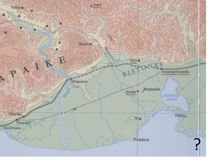
| Name (modern): | [near Xanthe?; unlocated] |
| Image: | 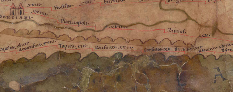 To the image detail |
| Toponym before | XIII Topiro |
| Toponym following | XXIII Porsulis |
| Alternative Image | --- |
| Image (Barrington 2000) |
 |
| Image (Scheyb 1753) | --- |
| Image (Welser 1598) | --- |
| Image (MSI 2025) | --- |
| Pleiades: | https://pleiades.stoa.org/places/507391 |
| Area: | Southern Balkans |
| Toponym Type: | Toponym, no Symbol |
| Grid square: | 7B4 |
| Toponym Color: | black |
| Vignette Type : | --- |
| Itinerary: | Cosinto (321,4) |
| Alternative Name (Lexica): |
|
| Name A (RE): | Kosintos |
| Name B (Barrington Atlas): | Cosinto (51 unlocated) |
| Name C (TIR/TIB/others): | Cosinto (TIR K 35/1, 23); Cosinto (TIB 6, 231f) |
| Name D (Miller): | Consinto |
| Name E (Levi): |
|
| Name F (Ravennate): | Cossimon (4,6 p. 48,29); Cositon (5,12 p. 93,3) |
| Name G (Ptolemy): | - |
| Plinius: |
|
| Strabo: |
|
| Dating from Toponym on TP: | Late Antiquity (from Diocletian and 4th century) |
| Argument for Dating: | Nur in den spätantiken Itineraren und ihren Kompilatoren erwähnt. |
| Commentary on the Toponym: |
Namensform nur hier belegt. |
| References: |
Kallintzi, Constantina: Η χώρα των Αβδήρων: συμβολή στην αρχαιολογία και ιστορική τοπογραφία του νότιου τμήματος του νομού Ξάνθης / The chora of Abdera: a contribution to the archaeology and historical topography of the south region of the prefecture of Xanthi, Bolos 2012. |
| Last Update: | 16.05.2025 17:44 |
Cite this page:
https://tp-online.ku.de/trefferanzeige_en.php?id=1139 [last accessed on June 26, 2026]