
Tabula Peutingeriana – Single display of hits
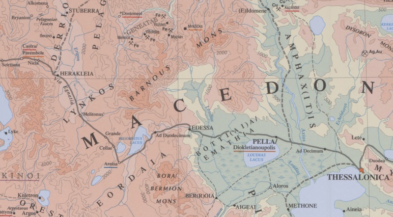
| Toponym TP (renewed): | Cellis |
| Name (modern): | bei Petres/Πέτρες |
| Image: | 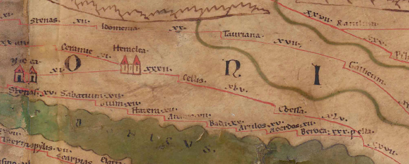 To the image detail |
| Toponym before | XXXII Heraclea |
| Toponym following | XLV Edessa |
| Alternative Image | --- |
| Image (Barrington 2000) |
 |
| Image (Scheyb 1753) | --- |
| Image (Welser 1598) | --- |
| Image (MSI 2025) | --- |
| Pleiades: | https://pleiades.stoa.org/places/481783 |
| Area: | Southern Balkans |
| Toponym Type: | Toponym, no Symbol |
| Grid square: | 7B1 |
| Toponym Color: | black |
| Vignette Type : | --- |
| Itinerary: | Cellis (319,2; 330,4); mansio Cellis (606,6) |
| Alternative Name (Lexica): |
|
| Name A (RE): | Kelle |
| Name B (Barrington Atlas): | Cellae (49 D3) |
| Name C (TIR/TIB/others): | Kelle (TIR K 34, 69f) |
| Name D (Miller): | Cellis |
| Name E (Levi): |
|
| Name F (Ravennate): | Celis (p. 51,39) |
| Name G (Ptolemy): |
|
| Plinius: |
|
| Strabo: |
|
| Dating from Toponym on TP: | Roman Imperial Period (Severan dynasty and 3rd century |
| Argument for Dating: | Erstmals belegt im ItAnt. |
| Commentary on the Toponym: |
Gleiche Namensform: |
| References: |
Edson, Charles: The Location of Cellae and the Route of the via Egnatia in Western Macedonia, Classical Philology 46 (1951), 1-16. |
| Last Update: | 15.01.2025 18:58 |
Cite this page:
https://tp-online.ku.de/trefferanzeige_en.php?id=1119 [last accessed on June 25, 2026]