


Tabula Peutingeriana – Einzelanzeige
| Toponym TP (aufgelöst): | Fluvius Indus |
| Name (modern): | Indus |
| Bild: | 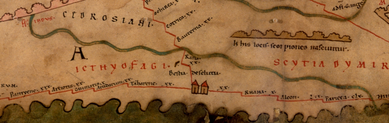 Zum Bildausschnitt auf der gesamten TP |
| Toponym vorher | |
| Toponym nachher | |
| Alternatives Bild | --- |
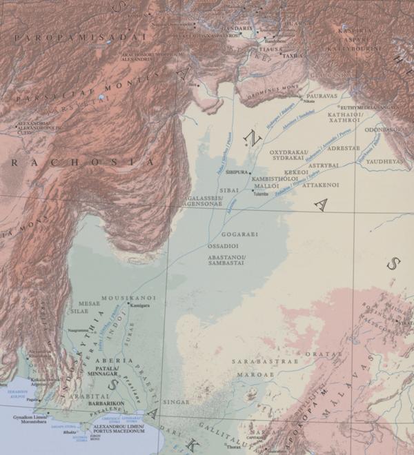
| Bild (Barrington 2000) |
 |
| Bild (Scheyb 1753) | --- |
| Bild (Welser 1598) | --- |
| Bild (MSI 2025) | --- |
| Pleiades: | https://pleiades.stoa.org/places/638870 |
| Großraum: | Indien |
| Toponym Typus: | Fluss |
| Planquadrat: | 11C2 / 11C3 / 11C4 |
| Farbe des Toponyms: | rot |
| Vignette Typus : | --- |
| Itinerar (ed. Cuntz): |
|
| Alternativer Name (Lexika): | Indos [1] (DNP) |
| RE: | Indos |
| Barrington Atlas: | Indus/Sinthos/Phison fl. (6 B4) |
| TIR / TIB /sonstiges: |
|
| Miller: | Fl` Indus |
| Levi: |
|
| Ravennat: | Indus (p. 17.47) |
| Ptolemaios (ed. Stückelberger / Grasshoff): | Ἰνδός (1,14,9; 1,17,3; 6,20,2; 6,21,1. 3f.; 7,1,2. 26. 27. 28. 42. 44f. 55. 64) |
| Plinius: |
|
| Strabo: |
|
| Autor (Hellenismus / Späte Republik): |
|
| Datierung des Toponyms auf der TP: | Archaik |
| Begründung zur Datierung: | Der Indus ist den Griechen seit dem späten 6.Jh. v. Chr. bekannt (vgl. Kommentar). |
| Kommentar zum Toponym: |
Der Indus, in der Antike zumeist als der größte Fluss Indiens dargestellt, er ist den Griechen seit dem späten 6.Jh. v. Chr. bekannt (Skylax bei Hdt. 4, 44). |
| Literatur: |
Miller, Itineraria, 846; Otto Wecker, in: RE IX / 2, 1916, 1369-1373 s.v. Indos 1; Jacques André / Jean Filliozat, Pline l’Ancien, Livre VI, Paris 1980, 101; Dies., L’Inde vue de Rome, Paris 1986, 441f. 448; Monique Kervran, Le delta de l’Indus au temps d’Alexandre. Quelques éléments nouveaux pour l’interprétation des sources narratives, in: Comptes rendus des séances de l’Académie des Inscriptions et Belles-Lettres 139/1, 1995, 259-312; Klaus Karttunen, India and the Hellenistic World, Helsinki 1997 (= Studia Orientalia 83); Monique Kervran, Le delta de l′Indus au temps d′Alexandre; Karttunen, in: DNP 5 s.v. Indus (Ἰνδός; Indós); John Williams, Isidore, Orosius, and the Beatus Map, in: Imago Mundi 49, 1997, 7-32; Scott D. Westrem, The Hereford Map: Α Transcription and Τranslation of the Legends with Commentary, Turnhout 2001, 56f. no. 114. 80f. no. 167; Klaus Geus, Die Geographika des Eratosthenes von Kyrene: Altes und Neues in der Terminologie und Methode, in: Michael Rathmann (Hrg.), Wahrnehmung und Erfassung geographischer Räume in der Antike, Mainz 2007, 111-122, hier 116 mit Anm. 38; Grant Parker, The Making of Roman India, Cambridge 2008, 11-65. 69-120; Alessandro Scafi, The Image of Persia in Western Medieval Cartography, in: Antonio Panaino / Riccardo Zipoli (Hrg.), Proceedings of the 5th Conference of the Societas Iranologica Europaea, Held in Ravenna, 6-11 October 2003, Volume II: Classical & Contemporary Iranian Studies, Milano 2006, 219-230, hier 220; Folker Reichert, Asien und Europa im Mittelalter, 2014, 451; Didier Marcotte, Die ethnische Komponente im Aufbau der antiken Karte, in: Susanne Grunwald / Kerstin P. Hoffmann / Daniel A. Werning / Felix Wiedemann (Hrg.), Mapping Ancient Identities. Methodisch-kritische Reflexionen zu Kartierungsparaktiken, Berlin 2018 (= Berlin Studies of the Ancient World 55), 27-35, hier 32. |
| Letzte Bearbeitung: | 15.09.2026 13:49 |
Cite this page:
https://tp-online.ku.de/trefferanzeige.php?id=2715 [zuletzt aufgerufen am 03.10.2026]