deutsch englisch spanisch französisch italienisch
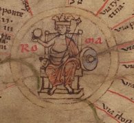
Ausschnitt aus der Tabula Peutingeriana - Rom

Tabula Peutingeriana – Einzelanzeige

Toponym TP (aufgelöst):

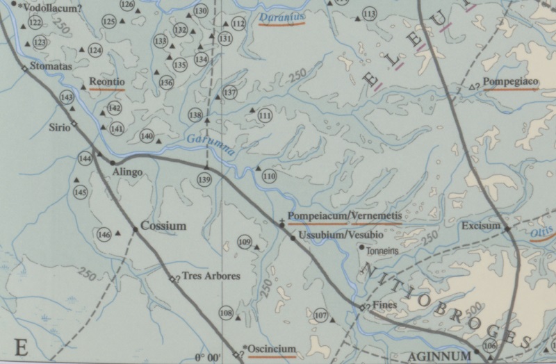
Fluvius Garunna

Name (modern):

Garonne

Bild:
Zum Bildausschnitt auf der gesamten TP
Toponym vorher Link     
Toponym nachher Link     
Alternatives Bild ---
Bild (Barrington 2000)
Bild (Scheyb 1753) ---
Bild (Welser 1598) ---
Bild (MSI 2025) ---
Pleiades: https://pleiades.stoa.org/places/138369
Großraum:

Gallien/Germanien

Toponym Typus:

Fluss

Planquadrat:

1B1 / 1B2 / 1B3 / 1B4 / 1B5

Farbe des Toponyms:

rot

Vignette Typus :

---

Itinerar (ed. Cuntz):


Alternativer Name (Lexika):

Garumna (DNP)

RE:


Barrington Atlas:

Garumna fl. (14 E4)

TIR / TIB /sonstiges:


Miller:

Fl. Garunna

Levi:


Ravennat:


Ptolemaios (ed. Stückelberger / Grasshoff):

Γαρύνα (2,7,2)

Plinius:


Strabo:


Autor (Hellenismus / Späte Republik):


Datierung des Toponyms auf der TP:

---

Begründung zur Datierung:


Kommentar zum Toponym:

Kommentar (Talbert):
The river seems to be named only at its source. If the name also appeared in the sea beyond the mouth, there is no sign of it.

Miller, Itineraria, Sp. 141:
Fl. Garunna (Nicht Carunna (Sch. etc.)) (steht an der Quelle), Garunna (Ra). Große Verwirrung; im ersten Verlauf Stellvertreter für die Nebenflüsse der Loire (Allier, Indre, Vienne), dann für die Charente; j. Garonne.

Datierung (Barrington):
Garumna fl. – Hellenistic/Roman/Late Antique (NPauly)

Eintrag Dictionary of Greek and Roman Geography:
GARUMNA (ὁ Γαρουνᾶς, Γαρὐνας: Garonne). Tibullus (1.7, 11) calls this river “Magnus Garumna:” but Ausonius (Mosella, 5.483) makes the name feminine (aequoreae ... Garumnae). The forms Garumna, Garonna, and Garunda occur; the last in a letter of Symmachus to Ausonius, and it is perhaps the origin of the name Gironde.

The Garonne, the most southern of the three great rivers of France which flow into the Atlantic, rises in the Pyrenees, within the present kingdom of Spain. The river has a north and NNE. course to Tolosa (Toulouse), from which town it has a general NNW. course to Burdigala (Bordeaux). Below Bordeaux it forms a large aestuary, which Strabo (p. 190) calls a sea-lake (λιμνοθάλασσα). The navigation of the Upper Garonne as far down as the junction of the Tarnis (Tarn) below Toulouse is much impeded. At Bordeaux it is a fine tide river, and the tide ascends 20 miles above Bordeaux. This river has several large branches: on the right bank, the Arriège, the Tarn, the Lot (Oltis), and the Dordogne (Duranius), which flows into the aestuary; on the left bank, the Gers, the Bayse, and some others. The length of the Garonne is said to be about 360 miles, and the Dordogne is near 300 miles long. In fact, the Dordogne and Garonne are two distinct rivers which flow into one aestuary, now called the Gironde. The basin of the Garonne is much less than that of the Loire, but larger than the basin of the Seine. It is a country which lies within well-defined limits, the Pyrenees, the Cévennes, the mountains of the Auveryne, and the Ocean. Part of the basin of the Garonne was the Aquitania of Caesar, who makes the Garumna the boundary between the Aquitani and the Celtae (B. G. 1.1).

Strabo (p. 190) and Mela (3.2) describe the; Garumna as rising in the Pyrenees. Strabo makes the Garumna flow parallel to the Pyrenees, and the navigable part of it he says is 2000 stadia: it is increased by three streams, and then enters the sea between the Santones and the Bituriges Iosci [BITURIGES], both Celtic nations. He speaks of the mouths of the river (αἱ ἐκδολαί) as forming the aestuary: he probably means the proper Garonne and the Dordogne. Mela`s description is much more complete: he describes the upper part of the riyer as shallow for a great distance and scarcely navigable, except when it is swollen by wintry rains or melted snow; as it approaches the ocean tides it is fuller, and becomes wider as it proceeds; at last it [p. 1.978]is like a great sea channel, carries large ships, and tosses navigators about in a furious manner, particularly when the wind and the stream are not the same way. Mela may probably have heard of the violence with which the tide enters the Gironde. Mela says that there is an island, Antros, in the aestuary of the Garonne; but there is no island now.

DNP:
Garumna

(Garunna, Γαρούνας). Einer der gall. Hauptströme (Tib. 1,7,11), h. Garonne und Gironde. Grenze der Galli zu den Aquitani (Caes. Gall. 1,1,1; 5; 7; Strab. 4,1,1; 2,1f.; 3,3; 5,2; Mela 3,20f.; Plin. nat. 4,105; Amm. 15,11,2). Strab. 4,2,1 zufolge über etwa 370 km schiffbar.

Lafond, Yves (Bochum)

"TP-Online-ID: 2488 — Fluvius Garunna

Desjardins S. 2.

Lesung und Namensform bei Desjardins: fl. Garunna; normalisierte Form: FLUVIUS GARUMNA.

Lage und Route bei Desjardins: Region/Lage: Gallia. Typ: Fluss. Route/Abschnitt: keine Route bzw. kein Abschnitt angegeben.

Quellenstellen bei Desjardins: keine Quellenstelle bei Desjardins angegeben.

Moderne Identifikation bei Desjardins: Garonne.

Kommentar und Forschungsstand bei Desjardins: Desjardins liest fl. Garunna und normalisiert zu FLUVIUS GARUMNA. Er weist ausdrücklich darauf hin, dass Scheyb die Kartenform falsch gelesen habe."

Literatur:

Desjardins, Table, p. 2, col. 1, no. 8.

Miller, Itineraria, Sp. 141.

R. Boudet (Hrsg.), Les Celtes, la Garonne et les Pays aquitains, 1992.

Y. Roman, Les Celtes, les sources antiques et la Garonne, in: Aquitania 12, 1994, 213-219.

H. Sion, Carte archéologique de la Gaule. 33/1 (Gironde), 1994.

   [Standard-Literatur-Liste im PDF-Format]

Letzte Bearbeitung:

20.08.2026 09:04

Druckversion erstellen


Cite this page:
https://tp-online.ku.de/trefferanzeige.php?id=2488 [zuletzt aufgerufen am 03.10.2026]

Impressum Datenschutzerklärung