deutsch englisch spanisch französisch italienisch
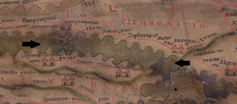
Ausschnitt aus der Tabula Peutingeriana - Rom

Tabula Peutingeriana – Einzelanzeige

Toponym TP (aufgelöst):

Avlon Cilicivs (Aulon Cilicius)

Name (modern):

z.T. MB von Tarsus (Miller)

Bild:
Zum Bildausschnitt auf der gesamten TP
Toponym vorher
Toponym nachher
Alternatives Bild ---
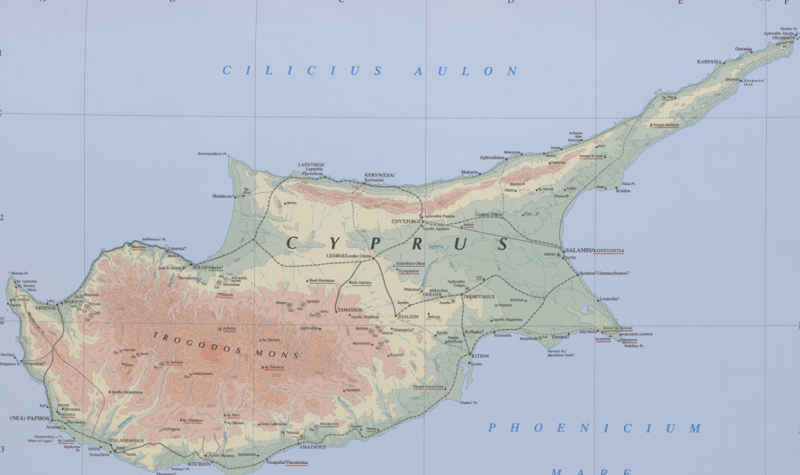
Bild (Barrington 2000)
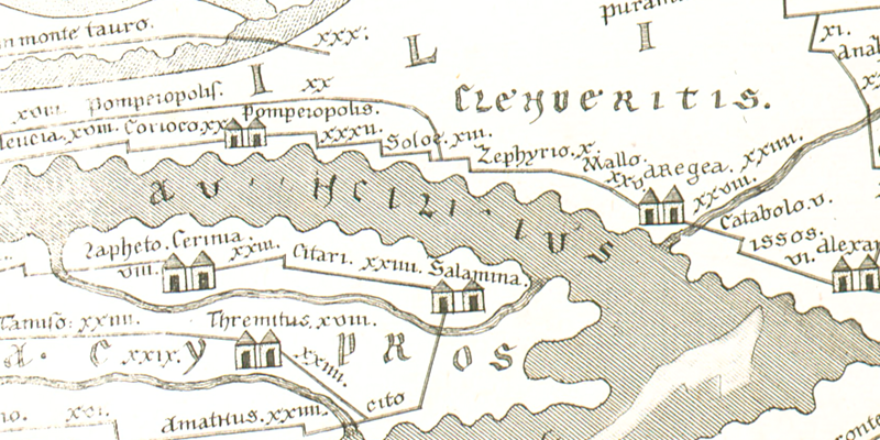
Bild (Scheyb 1753)
Bild (Welser 1598) ---
Bild (MSI 2025) ---
Großraum:

Mittelmeerinseln

Toponym Typus:

Wasser (ohne Flussname)

Planquadrat:

9B3 / 9B4

Farbe des Toponyms:

schwarz

Vignette Typus :

---

Itinerar (ed. Cuntz):


Alternativer Name (Lexika):


RE:

Aulon [10]

Barrington Atlas:

Cilicius Aulon (66 F4) (Cilicium Mare)

TIR / TIB /sonstiges:


Miller:


Levi:


Ravennat:


Ptolemaios (ed. Stückelberger / Grasshoff):


Plinius:

Aulona Cilicium (5,130)

Strabo:


Autor (Hellenismus / Späte Republik):


Datierung des Toponyms auf der TP:

---

Begründung zur Datierung:


Kommentar zum Toponym:

[Kommentar (BH):
Welser liest "AVLONCILICIVS", Scheyb liest "AU[..]NCILI[.]IUS"]

Kommentar (Talbert):
The one seemingly identifiable letter - below the Mallo route stretch (9B4) - confirms that the sea hereabouts was named. Otherwise I detect no more than the merest traces of lettering ahead of the "S", so that the name remains beyond recovery. Just possibly, however, there is another "S" above Salamina.

Miller, Itineraria, Sp. 955:
Avlon Cilicivs, (So Bt, Bg, Ve; j. nur noch erkennbar Au..n. Cilicivs (Sch, Ma, Pd, Kt); irrig Sinvs Cilicivs (Dj), ἡ αὐλών - eigentlich Tal, Engpaß, für Meerenge öfters gebraucht (πόντιαι αὔλωνες), speziell für die Meerenge zwischen Cyprus und Zilizien bei Luc. navig. 7, Pl 5,25, Αὐλών Κελικιος (Pt), Mare Cilicium (St), πέλαγος τὸ κατὰ τὴν Κιλικίαν (Acta App), Ciliciae fretum (Pt), Cilici[n]us sinus (Hi 2, Or, Is), Cilicius Aulon (Or); j. z.T. MB von Tarsus

[T.W.] Heute ist nur noch "[-?-] CILICIUS" lesbar. Bei Welser findet sich "AVLON CILICIVS", bei Scheyb "AU[..]N CILI[.]IUS". In antiken Quellen ist "Κιλίκιος Αὐλών" (Ptol. 5,8,1; 5,14,4) belegt.

RE:
10) Der Meeresteil zwischen Kilikien und Kypros, Luc. nav. 7, mit dem Beisatz Κιλίκιος, Ptol. VI 4, 4. Nic. Greg. VI 8, 1; Cilicius Plin. n. h. VI 30. Tab. Peut. X. Oros. I 2, 96. Aeth. cosmogr. II 49; Ciliciae [Hier, presb.] dimens. provinc. 5, auch Cilicius sinus Oros. I 2, 25.
[Oberhummer. ]

Dimensuratio Provinciarum 5
Mons Taurus. Insula Cyprus (finitur) ab Oriente
mari Syrio, ab occidente Pamphylio, a septentrione
Aulone Ciliciae, a meridie mari Phoenicio. cuius spatia in longitudine m.p. CLXXV, in latitudine m.p. CXXV.
Berg Tauros. Die Insel Kypros wird im Osten vom Syrischen Meer begrenzt, im Westen vom Pamphylischen, im Norden vom Aulon Kilikiens und im Süden vom Phoinikischen Meer. Ihre Flächen (haben) in der Länge 175 Meilen und in der Breite 125 Meilen.

Literatur:

Miller, Itineraria, Sp. 955;

   [Standard-Literatur-Liste im PDF-Format]

Letzte Bearbeitung:

10.09.2026 12:57

Druckversion erstellen


Cite this page:
https://tp-online.ku.de/trefferanzeige.php?id=2382 [zuletzt aufgerufen am 03.10.2026]

Impressum Datenschutzerklärung