


Tabula Peutingeriana – Einzelanzeige
| Toponym TP (aufgelöst): | Salolime |
| Name (modern): |
|
| Bild: | 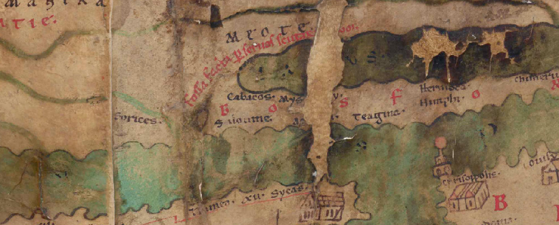 Zum Bildausschnitt auf der gesamten TP |
| Toponym vorher | |
| Toponym nachher | |
| Alternatives Bild | --- |
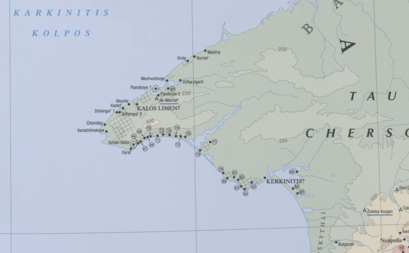
| Bild (Barrington 2000) |
 |
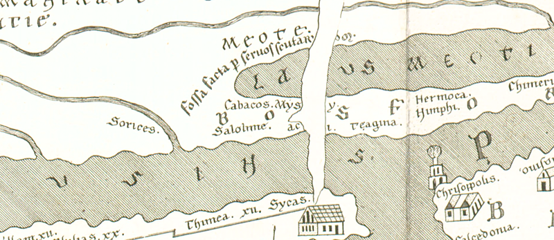
| Bild (Scheyb 1753) |
 |
| Bild (Welser 1598) |
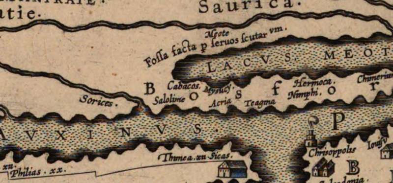 |
| Bild (MSI 2025) | --- |
| Pleiades: | https://pleiades.stoa.org/places/226646 |
| Großraum: | Skythien |
| Toponym Typus: | isolierter Name |
| Planquadrat: | 8A1 |
| Farbe des Toponyms: | schwarz |
| Vignette Typus : | --- |
| Itinerar (ed. Cuntz): |
|
| Alternativer Name (Lexika): |
|
| RE: | Salolime (619) |
| Barrington Atlas: | Kalos Limen? (23 F3) |
| TIR / TIB /sonstiges: |
|
| Miller: |
|
| Levi: |
|
| Ravennat: |
|
| Ptolemaios (ed. Stückelberger / Grasshoff): |
|
| Plinius: |
|
| Strabo: |
|
| Autor (Hellenismus / Späte Republik): |
|
| Datierung des Toponyms auf der TP: | --- |
| Begründung zur Datierung: |
|
| Kommentar zum Toponym: |
Der Eintrag ist, so bereits Miller, möglicherweise ein Kopistenfehler und als Kalos Limen zu rekonstruieren. Hier ist also noch deutlich das griechische Toponym zu erkennen. Es könnte an dieser Stelle zu erst der griechische Name Καλός λιμήν gestanden haben, welcher schließlich in einem der frühen Kopier- und Überarbeitungsschritte latinisiert wurde, ohne dass λιμήν mit dem lateinischen Äquivalent portus übersetzt wurde. |
| Literatur: |
Matija P. Katančić, Orbis antiquus ex tabula itineraria quae Theeodosii Imp. et Peutingeri audit ad systema geographiae redactus et commentario illustratus, Pars I, Buda 1824, XL. 216f.; Miller, Itineraria, Sp. 619; S.Y. Vnukov, The North-Western Crimea: An Historical-Archaeological Essay, in: Gocha R. Tsetskhladze (Hrg.), North Pontic Archaeology: Recent Discoveries and Studies, Leiden 2001 (= Colloquia Pontica 6), 149-175, hier 156f. 175; Alexander V. Podossinov, Eastern Europe in Roman Cartographic Tradition, Moscow 2002, 345 [in Russian]; Sergey L. Solovyev, Chorai of Borysthenes, Olbia, Nymphaeum and Hermonassa: Investigation Results and Comparative Study, in: Sergey L. Solovyev (Hrg.), Greeks and Natives in the Cimmerian Bosporus, 7th - 1st Centuries BC. Proceedings of the International Conference, October 2000, Taman, Russia, Oxford 2007 (= British Archaeological Reports / International Series 1729), 117-121; Jane H. Petersen, Cultural Interactions and Social Strategies on the Pontic Shores: Burial Customs in the Northern Black Sea Area C. 550-270 BC, Aarhus 2010, 121. 147. 148. 149. 150. 151. 160. 163. 167. 177. 194. 262 (Kurgane vor allem im 4. und frühen 3.Jh. v.Chr. angelegt); Raoul McLaughlin, The Roman Empire and the Silk Routes: The Ancient World Economy & the Empires of Parthia, Central Asia & Han China, Peter Attema, Power at a Distance: The Hellenisitc Rural Exploitation of the „Farther“ Chora of Chersonensos (Crimea; Ukraïne) from the Perspective of the Džarylgač Survey, in: Bleda S. Düring / Tesse D. Stek (Hrg.), The Archaeology of Imperial Landscapes: A Comparative Study of Empires in the Ancient Near East and Mediterranean World, Cambridge 2018, 115-144, hier 123ff. |
| Letzte Bearbeitung: | 08.07.2026 14:32 |
Cite this page:
https://tp-online.ku.de/trefferanzeige.php?id=1955 [zuletzt aufgerufen am 03.10.2026]